Isionova Elena Petrovna
Place of work, position:
Geography teacher
Kemerovo region
Resource characteristics
Levels of education:
Basic general education
Levels of education:
Secondary (complete) general education
Class(es):
Class(es):
Class(es):
Item(s):
Geography
The target audience:
Learner (student)
The target audience:
Teacher (teacher)
Resource type:
Didactic material
Brief description of the resource:
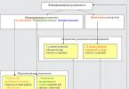
The manual contains tasks for determining the subjects of the Russian Federation. The text of the tasks contains the most striking features of some subjects of the Russian Federation, which allow you to determine what kind of subject it is. The republics, territories and some regions of our country are described in the materials. They will help you get your hand in preparation for the final state testing.
5. This republic borders on three countries. The only thing urban settlement- the capital, in which lives about .... the population of the republic. Like most mountainous territories, it is populated extremely unevenly: most of the villages and villages are located along rivers, as well as in intermountain basins. The positive dynamics of the number of both urban and rural population remains in the republic. The share of industry in the structure of the economy is one of the lowest in the country. Developed: food industry, mining of non-ferrous metal ores, production of building materials. 10. This republic is part of the Ural economic region. Neighbors are two republics, one region and one region. The Republic is one of the most urbanized and militarized regions of the Russian Federation. In terms of the share of the military-industrial complex, it is one of the first places in the Russian Federation. Small arms are produced in the capital. The automotive industry is one of the branches of specialization of the capital. Oil is being produced in the republic. Power plants have been built, metallurgy, timber and wood processing industries have been developed. The indigenous population belongs to the Finno-Ugric group of the Ural family. Their old name is votyags. 15. The main territory of the republic is located on the left bank of the Volga. From natural resources timber is of great importance, therefore wood processing stands out in the industrial complex of the republic. Of the industries, the most developed are also mechanical engineering, electric power and the food industry. At the same time, the level economic development republic is quite low. This is also due to the fact that important transport routes almost do not pass through its territory. The population of the republic is not large. AT national composition Russians dominate. 24. The Republic is located in the center of the European part of the Russian Federation, in the Volga River basin. The republic is surrounded by large cities and industrial centers - Nizhny Novgorod, Kazan, Samara, Tolyatti, Ulyanovsk, Penza, Ryazan. A number of main gas pipelines pass through the territory of the republic (from fields in the northern part Western Siberia), as well as the gas pipeline Saratov - Nizhny Novgorod. Ethnic composition: Russians -60.8%, titular nation - 31.9%, Tatars -5.2%, other nationalities - 2.1%. The titular nation belongs to the Finnish group of the Ural family. The republic is among the top five in the Russian Federation in the production of meat, milk and eggs per capita. There are no large mineral deposits on the territory of the republic. Here is the largest plant in Russia for the production of cement of various grades. The republic is the southern border of the Volga-Vyatka region. 25. The second largest republic in its region after Adygea, where the titular nation does not prevail. On the border of this republic and Kabardino-Balkaria is the highest peak of the Caucasus. There is an abundance of water resources: about 130 high-mountain lakes, many mountains of waterfalls, 172 rivers flow. The bowels of the republic are rich in natural resources: coal, granite, marble, ores, clay, medicinal mineral waters, thermal waters. Here are the Teberdinsky reserve, part of the Caucasian one. The rural population predominates. multinational republic. Production is represented in the north by the chemical industry, mechanical engineering, and light industry. In the south - mining, woodworking and animal husbandry. Tourism, mountaineering and resort economy are of great importance for the region. 41. The territory of this region is flat and low-lying located on the seashore. The climate is transitional from maritime to continental. The vegetation has been heavily modified by man. The population is represented mainly by Russians, with half of the total population concentrated in the regional center. The main branches of specialization are fish, mechanical engineering and pulp and paper. In the future, seaports can serve the needs of not only Russia, but also Belarus and Poland. In addition, the region is the center of the amber industry. 52. The region is part of the northwestern economic region. It has no direct access to the sea, has no foreign neighbors. The area is located in the forest zone. It is not rich in minerals (peat, brown coal, refractory and building clay, bauxite and other minor deposits). But the region is rich in mineral and radon springs, therapeutic mud. 90.8% of the total volume of industrial production of the region is occupied by manufacturing industries, among which the leading place belongs to the chemical, metallurgical, woodworking and food products, machinery and equipment, including electronic, optical and electrical equipment. The Valdai National Park is located on the territory of the region. 54. On the territory of the region there is a semi-enclave of the Russian Federation. Of the seven neighbors, two are foreign and one is a semi-enclave. The region is located entirely on the East European Plain within the Atlantic-continental climate. There is a lot of precipitation in summer and autumn. There are a lot of lakes in the region, including the largest in Europe. A significant part of the region is swampy. It is located in the taiga zone, but the resources are severely depleted. The capital is the largest agglomeration and port of the country. The region accounts for 38.8% of the total Russian production of natural tea, 15.1% of cigarettes and cigarettes, 14.8% of cardboard, 12.5% of paper, cellulose. 57. The region as part of the central economic region has a border position with two foreign countries. A significant part of the region is covered with forests (
2. The Republic of the Russian Federation, which is part of the East Siberian economic region and is part of Transbaikalia. Here are the largest deposits of tungsten and molybdenum ores in the Russian Federation. Breeding horses is practiced on the territory of the republic in order to obtain meat and milk (koumiss). Here, such a branch of animal husbandry as sheep breeding is well represented. The population of the republic belongs to the Altai family of the Mongolian group. They practice Buddhism.
The main railway line of the country passes through the capital of the republic, connecting the European part of the country with the Far East.
The capital is the center of the aircraft industry. There are also factories for the production of locomotives, various devices. They are complemented by the food, light and glass industries.
(Buryatia)
3. The Republic of the East Siberian region, the population of which belongs to the Altai family of the Turkic group. The indigenous population of the republic is 64%, which professes Buddhism. The rural population in the republic prevails. The rural population is engaged in wool and meat sheep breeding and meat and dairy cattle breeding, due to the high continental climate. Yaks are bred on the territory of the republic. The subject is characterized by positive natural population growth. But it has the lowest life expectancy in the country.
4. The Republic is an eastern neighbor Kemerovo region. The capital of the republic is located on the left bank of the Yenisei River. Here is the largest hydroelectric power station in the Russian Federation. Steppe PCs with a dry climate prevail on the territory of the republic. As a result, many salt lakes have formed here, which are used in the recreational economy of the republic. Along with energy, it is a sector of specialization of the economy of the republic. The basis of the entire economy of the region is the technologically related hydropower and aluminum production. Agriculture is represented by fine-wool sheep breeding and dairy farming. Horse breeding also plays an important role. The population of the republic belongs to the Altai family of the Turkic group. The indigenous population is represented by only 11.1%. The rest of the population is Russian. (R. Khakassia)
6. The capital of the republic - the city of a millionaire is located on one of the left tributaries of the Kama River. The population of the republic belongs to the Altai family of the Turkic group, professes Islam. The titular nation in the republic is 22%, Russians here are 39%, Tatars are 28% Oil is extracted here. Such industries as aircraft engine building, helicopter production, petrochemistry and oil refining are represented in the capital. The capital is the largest oil refining center in the country. The republic is part of the Ural economic region.
(R. Bashkortostan)
7. This republic is part of the Volga region. The capital of the republic, the city of a millionaire, is located on the banks of the river. Volga and is one of the oldest cities in the Russian Federation. The aviation industry (helicopters and airplanes) is well represented in the capital. Heavy dump trucks, equipment for the fuel and petrochemical industries are produced. One of the leading branches of the republic's specialization is oil production and refining. Light industry is represented by fur industry. Agriculture is represented by dairy and beef cattle breeding. The titular nation is the second largest people in the Russian Federation. The indigenous population professes Islam.
(r. Tatarstan)
8. The extreme southern point of the Russian Federation is located on the territory of this republic. The population is represented by a North Caucasian family professing Islam. The titular nation prevails here -80.2%. The rural population is above 50%. Capital major port republics. Due to the dry climate in agriculture, sheep breeding is more developed on mountain pastures. The Republic is one of the fruit-growing regions of the country.
(river Dagestan)
9. This is the only republic of the Urals - the Volga region, where the indigenous population absolutely prevails (70%). One of the densely populated regions of the European part of the Russian Federation, much less urbanized than its neighbors. The villagers grow such a labor-intensive crop as hops. Tractors, electrical engineering and appliances are produced in the capital. The population belongs to the Turkic group of the Altai family, professes Orthodoxy.
(R. Chuvashia)
11. Republic within the Northern Economic Region, which has its own energy resources. Including 8-9% of coal production in the Russian Federation. Oil and gas production is of local importance here. There are also salt deposits here. The republic is rich in forests. The capital of the republic is one of the largest timber industry complexes in the country.
The population is unevenly distributed. It belongs to the Ural-Yukaghir family of the Finno-Ugric group.
Energy is represented by thermal power plants. The transport network is poorly developed.
12. Pasture sheep breeding is well developed in the republic. Despite the dry climate, the republic is very densely populated. The population belongs to the Altai family of the Mongolian group. The indigenous people practice Buddhism. A positive population growth is typical for the republic. The rural population predominates. The republic is located on the coast of the largest lake in the world. It is the largest republic in its region by area.
(R. Kalmykia)
13. This republic borders on the Nizhny Novgorod and Ulyanovsk regions and three republics. In the very north, its territory is crossed by the Volga. The two largest cities of the republic (the capital and its satellite, which arose as a settlement during the construction of a hydroelectric power station), are located on the banks of the Volga reservoir. Industry is concentrated in the capital - an industrial tractor factory, a cotton mill and a knitwear factory. The indigenous population belongs to the Turkic group, they profess Orthodoxy.
(R. Chuvashia)
14. This republic borders on only one subject of the Russian Federation, because its territory is, as it were, within it. The northern part of the republic is located on the Kuban lowland, the southern part is on the slopes of the Caucasus. Forests growing in the mountainous part of the republic occupy about 40% of the territory and consist mainly of broad-leaved tree species. Mountain tourism is developed here. The sectoral structure of the industry is dominated by food, followed by timber, woodworking and pulp and paper. The capital is the largest industrial center.
(r. Adygea)
16. The territory of this republic is located in the European part of the Russian Federation in the zone of mixed forests. But the forest cover of the territory is not high, since most of the forests have been cut down. The capital of the republic is a millionaire city, which is a large industrial center. On the territory of the republic there is the largest reservoir in terms of area. The oil industry plays an important role in the republic's economy.
(r. Tatarstan)
17. In terms of population, this republic is the second in its region. The proportion of the indigenous population is just over 20%. These are the people of the Turkic group, professing Islam. In the structure of industry, oil, chemical and petrochemical industries stand out. The republic is known as one of the country's largest suppliers of synthetic rubber, plastics and soda. Agriculture also plays a significant role in the economy of the republic. First of all, we are talking about grain farming. In addition, it is here that beekeeping has historically developed.
(R. Bashkortostan)
18. In this republic, through whose territory the Volga River flows, the indigenous population is 70%. Despite the fact that its territory is located in the main zone of settlement, there are no cities of millionaires in the republic. abundance labor resources allows growing hops, there are significant crops of sugar beets. Among the branches of industry, mechanical engineering (electrical engineering, tractor production), chemical, textile, and food industries stand out. A large hydroelectric power station operates on the territory of the republic.
(r. Chavash)
19. This republic occupies the territory on the right and left banks of the Volga. The capital is not a city of millionaires. The majority of the population is Russian. Of the industries, the most developed are mechanical engineering, electric power, forestry, woodworking and pulp and paper.
(R. Mari El)
20. The name of this republic is translated as a country of mountains. The average January temperature is from -1 to -11 degrees. The snow cover is small, but can reach great heights in the valleys. Summer here is very warm, but at an altitude of 3000m the temperature is about 0 degrees. Alpine and subalpine meadows are used as pastures. This is a multinational republic, where several dozen ethnic groups live (Avars, Kumyks, Lezgins, Laks, etc.). The republic is known for such crafts as: the manufacture of daggers with chasing and inlay on the handle, decorated scabbards, the production of woolen products (felts, cloaks), rugs, carpets.
(r. Dagestan)
21. On the territory of this subject of the Russian Federation, hilly-morainic relief prevails, there are many lakes and rivers belonging to the basin of the Atlantic and Arctic oceans. The leading industrial complex is timber, and the leading branches of agriculture are dairy and meat animal husbandry, fishing and fur farming. Hydropower prevails, tourism and sanatorium-and-spa treatment are rapidly developing. In 1987, on the basis of its own iron ore deposits, a mining and processing plant was built in this subject.
(R. Karelia)
22. This subject of the Russian Federation is located on the northern slope of a large mountain system in Russia. Plain steppes are changing here deciduous forests, subalpine and alpine meadows. A large deposit of tungsten-molybdenum ores contributed to the development of non-ferrous metallurgy here, and a sufficient amount of labor resources - to the development of such industries as mechanical engineering (production of appliances and woodworking machines) and light industry (production of clothing and knitwear). The subject has one of the largest resorts in Russia, the main areas of which are skiing, mountain tourism, and mountaineering. The highest point in Russia is located on the territory of the republic.
(R. Kabardino-Balkaria)
23. The Republic occupies an area of 8 thousand square meters. km 2 (0.05% of the Russian Federation). Population density - 82.5 people. per km 2. The territory of the republic is represented in the south by mountains in the north - by an inclined plain with low ridges. The soils are chestnut and chernozem. The climate is temperate continental, arid on the plain. Winters are short and mild, summers are hot. The population is represented by 97 nationalities. The only republic in its region, the population of which professes Orthodoxy. There are such minerals here as polymetals containing zinc, lead, silver; building materials, dolomites, mineral water springs. Explored oil reserves. The main industries are non-ferrous metallurgy, mining, machine-building, electrical engineering and starch processing (one of the largest maize plants in Europe). Since 1994, the republic has a second name
(North Ossetia- Alanya)
26. Muslim republics between which the borders are not demarcated. Due to constant instability, the proportion of unemployed is high. The peoples of the Caucasian family live here, repeatedly subjected to repression. Unlike other subjects of the Russian Federation, there is a high natural increase.
(river Chechnya and Ingushetia)
27. This region has a seaside geographical position. The administrative center is equally distant from the equator and North Pole. Favorable natural conditions contributed to the development of a powerful agricultural industrial complex. In the total population, the share of rural residents is much higher than the national figure. Rural settlements in the region are called villages. The population is multinational, the region is one of the main regions that receive migrants.
(Krasnodar)
28. This region has access to two seas, it borders on land with one of the foreign countries. Most of the territory is lowland, in the south there are young high mountains. A feature of the climate is a short cold period of the year. The main wealth of the region is agro-climatic resources.
(Krasnodar)
29. This region has a coastal geographical position. The southern border of the region coincides with state border Russia. The riches of the region include recreational resources: the sea coast, picturesque alpine landscapes, healing mineral springs; agroclimatic resources; fertile chernozems are widespread on the flat part, which, combined with a warm climate, contributed to the development of agriculture. One of the main branches of the regional economy. Here they grow wheat (more than 10% of the total Russian production), corn, rice, grapes, citrus crops (1st place in terms of production of grain, sugar beets, fruits and berries.) It ranks second in the production of sunflower seeds and honey, in the production of eggs and meat . Third in milk production.
(Krasnodar)
30. The climate of this subject of the Russian Federation is moderately monsoonal, precipitation falls from 600 to 1000 mm per year. On the plains, coniferous-broad-leaved forests grow, in mountainous areas - fir, larch, and cedars are found. Two major highways pass through the subject of the Russian Federation: one was built at the end of the 19th century, the other was built in the last quarter of the 20th century. There are two large oil refineries on the territory, operating on raw materials supplied from a neighboring subject of the Federation. Agriculture is represented in the north of the region by reindeer breeding, in the south by dairy and beef cattle breeding and pig breeding. At the same time, this is the most urbanized region of the Russian Federation. (80.6% of citizens).
(Khabarovsk)
31. This region of the Russian Federation does not go to the land and sea borders of Russia. Most of it is a flat area with fertile black soil. In the mountainous areas located in the south, there are resorts known for their mineral springs. The main specialization of the economy of this entity is the food and chemical industries, working on their own resources. Due to internal and external migrations to this area, an increase in the population has been observed in recent years.
(Stavropol)
32. A feature of the geographical position of this region is the lack of access to the sea. Part of its territory is occupied by low mountains, but most of it has a flat relief. Deposits of a wide variety of minerals have been discovered in the region, including one of the world's largest deposits of potash salts. The leading industries are chemical and petrochemical, mechanical engineering and timber industry.
(Permian)
33. In this region, 70% of the coal reserves of the Russian Federation. On its territory is the largest peninsula of the Russian Federation. It is located in the Yenisei River basin. The geographic center of the country is located on the territory of the region. (In the vicinity of Lake Vivi-Evenkia). It occupies one of the first places in Russia in terms of gold mining. Here are the main reserves of copper-nickel ores, platinum, Icelandic spar. The largest aluminum plant is located in the capital. In the north of the region there is the largest plant in the Russian Federation for the production of copper-nickel ores, operating on its own raw materials. Due to the abundance of water and hydropower resources, the region has its own pulp and paper mill.
(Krasnoyarsk)
34. This subject of the Russian Federation is located on one of the peninsulas of the country. About 2/3 of the territory is occupied by young folded mountains covered with tundra and wooded vegetation. There are 30 active and 130 extinct volcanoes on the peninsula. Here is the highest active volcano in Russia. In addition to thermal power plants in the region, non-traditional power plants (GTPPs) also serve the needs of the population and production. The Valley of Geysers is one of the recreational resources of the region. Here is the Kronotsky Biosphere Reserve. There are frequent earthquakes here.
(Kamchatsky)
35. This subject of the Russian Federation borders on land with two foreign states, and the straits share it with the country-archipelago. An important railway line passes here, connecting the subject with the European part of the Russian Federation. There are conversion metallurgical plants operating on their own resources. Transport engineering is well developed here. This is the only place in the country where many relic plants and rare animals have been preserved. Lots of endemics. It combines coniferous and broad-leaved species of plants. In the taiga there are black bear, spotted deer, tiger and other animals. The reasons for this diversity of nature are the huge extent from north to south, the weak manifestation of glacial activity in the Quaternary period and the monsoon climate.
(Seaside)
36. This subject of the Russian Federation was formed relatively recently. It is located in the Siberian Federal District and the East Siberian Economic Region. Has two foreign neighbors. The subject has a large hydro potential, but it has not been realized. Here is the country's largest copper deposit. (Udokan). The region is the main developing resource base of the country's nuclear industry. The largest reserves of molybdenum, tin, lanthanum and polymetals are also located here.
(Transbaikal)
37. This region has no maritime borders. Has one foreign neighbor. Almost all natural zones of Russia are present in the region - steppe, forest-steppe, taiga and mountains. About 2000 plant species grow here. There are many endemics and relict plants among them: golden root, maral root, etc. Mineral resources in the region are diverse. But the unique deposits of jasper, porphyry, marble, granite, mineral and drinking water, natural therapeutic mud, ocher. Despite the uniqueness of nature, there are no national parks or reserves here. There is a famous and very popular health resort in the Russian Federation in the region. The region is a traditional producer of grain, milk, meat; sugar beets, sunflowers, flax, and hops are grown. Mechanical engineering is of great importance in industry (caterpillar tractors and plows, steam boilers, mainline cars, diesel engines, tires, press-forging equipment, drilling machines, generators for tractors and automobiles).
(Altaic)
38. This area is located in the forest zone. A feature of its EGP is the border position with one of the CIS countries. The most important transport routes connecting the Russian Federation with the countries of Western Europe pass through its territory. There are no minerals other than peat, building materials and small reserves of brown coal in the region. The main industries are engineering, chemical, light and food industries. The region's economy is supplied with energy by a large modern nuclear power plant.
(Smolensk)
39. This region is located in the south of the European part of the Russian Federation. Among minerals highest value has gas and table salt. Agricultural production is one of the basic branches of the region's economy. The development of vegetable growing and melon growing is facilitated by natural conditions - an abundance of light, heat, and the proximity of water sources. More than 90% of the volume of vegetable production is occupied by tomatoes. The animal husbandry of the region is represented by dairy and beef cattle breeding, sheep breeding, poultry farming, herd horse breeding and camel breeding.
(Astrakhan)
40. main center this area, which is a millionaire city, is located on the coast major river. In the south, the region borders on one of the CIS countries. The region has large deposits of oil and gas. However, 42.3% of total industrial production is accounted for by automotive production.
(Samara)
42. This area is one of the largest in the Central region, but one of the sparsely populated. It has large stocks of commercial timber. One of the largest thermal power plants in European Russia is located in the region. Mechanical engineering, timber and textile industries are developed. One of the largest factories of medical preparations is located here, there is a production of products from gold and platinum. Agriculture has a flax and dairy direction with potato growing and grain crops. There is a well-known breeding farm in the region, specializing in the cultivation of cattle.
(Kostroma)
43. This region has access to three seas. The main natural resources are forest resources, diamond reserves, peat and fish resources. The leading industries are the timber, woodworking and pulp and paper industries, shipbuilding and ship repair (the only center in the Russian Federation for the production of nuclear submarines), and the fishing industry. The administrative center of the region is a major timber export port of the country. Here is the cosmodrome - Plisetsk. Representatives of one of the small peoples of Russia belonging to the Ural-Yukagir language family live compactly on its territory. The only center in the Russian Federation for the production of nuclear submarines. Here is the cosmodrome - Plesetsk.
(Arhangelsk region)
44. More than half of the territory of this region is occupied by forests. A feature of its EGP is its position on the main transport routes connecting Europe with the Far Eastern regions of Russia and the countries of the Asia-Pacific region. The basis of the economy is made up of several large hydroelectric power stations, next to which large aluminum plants and timber processing complexes have been built. The extraction of gold, iron ore and coal is also of great importance.
(Irkutsk)
45. This region within the Russian Federation has a coastal position. It is the largest in terms of territory and the most urbanized subject of the Russian Federation in the south of the country. The main highways connecting the regions of Russia with the southern neighboring states pass through the regional center - the city of a millionaire. In the youngest city of the region there is an enterprise of nuclear engineering. The main sectors of the economy: mechanical engineering and food industry, diversified agriculture. The region occupies a leading position in the production of grain, sunflower and vegetables.
(Rostov)
46. Despite its marginal position, this area has a favorable EGP. It borders on two European countries, and on its territory there is the largest ice-free port of the Northern sea route. The region is distinguished by the highest level of urbanization in Russia. The basis of its economy is a complex of mining and fish processing industries. The only TPP in Russia is located here. On the territory of the region there is the only TPP in the Russian Federation.
(Murmansk)
47. The EGP of this region is determined by the passage through the territory of transit railways connecting Moscow and St. Petersburg with the Urals and the entire Asian part of Russia. The administrative center stands on the right tributary of the Kama. The region has significant forest resources, and the main branch of specialization is the forestry and woodworking industry. Commercial timber is harvested here, lumber, wood-based panels, furniture, skis and paper are produced. Developed: mechanical engineering, chemical and light industries. The largest industrial hub of the region is its administrative center with satellite cities. Since ancient times, fur and leather crafts have been widely developed. It was in this area that the production of the famous Dymkovo toy was born.
(Kirovskaya)
48. This region ranks second in the Central region in terms of population density. This is one of the regions of the Russian Federation with the largest share of the elderly population in the age structure. There are several large power plants in the region, which used to be oriented to local coal, but have now been switched to natural gas and imported coal. The basis of industry is chemical enterprises (production of mineral fertilizers, household chemicals, chemical fibers, synthetic rubber). In mechanical engineering, a set of factories of the military-industrial complex stands out. In addition, the region produces equipment for the chemical industry, railway transport, harvesters, radio products. In the administrative center there are enterprises for the production of iron and ferroalloys; the city has long been famous for its weapons. The region is famous for the production of samovars, button accordions, and gingerbread.
(Tula)
49. This area in the European part of the Russian Federation occupies a border position. The basis of the electric power industry is a large nuclear power plant. The industry is represented by mechanical engineering enterprises - electrical and radio engineering, instrument making. The region stands out for the production of flax fiber and linen fabrics, knitwear. The most important transport routes of Russia pass through the territory of the region. The administrative center stands in the upper reaches of a large river flowing into the Black Sea.
(Smolensk region)
50. The Volga divides the territory of this region into two parts. The economic complex is distinguished by the electric power industry (large thermal power plants, hydroelectric power stations, nuclear power plants operate), mechanical engineering, petrochemistry, and the food industry. Spring wheat, sugar beet, and sunflower are grown on chernozem and chestnut soils. The administrative center of the region has long been one of the centers of grain trade and flour-grinding industry in the Russian Federation. Now it is a large industrial, scientific and cultural center. The city has enterprises for the production of aircraft, automotive equipment, the chemical industry and oil refining. The city is a major transport hub - it is a river port, it stands at the intersection of iron and highways, gas pipelines pass through it. The population of the regional center has not yet reached 1 million and is 879 thousand people.
(Saratovskaya)
51. The region ranks first in the Russian Federation in terms of the Russian-speaking population - 96.6%. The relief is hilly - lowlands, ridges, hills alternate. The climate is temperate continental with cold winters and warm summers. There is quite a lot of precipitation, evaporation is low, so there are many lakes, rivers and swamps. Snow cover lasts 160-170 days. The vegetation is taiga (mostly spruce). The region is not rich in minerals - peat, building materials, table salts and mineral waters, river pearls are found in the rivers. The natural increase and the balance of migrations are negative. The main branch of specialization is ferrous metallurgy. Here is one of the largest centers for the production of ferrous metals. The region exports, in addition to industrial products, milk, poultry, meat, and butter.
Some folk crafts have survived here to this day - lace-making, carved Shemogod birch bark, blackening on silver. Here is the birthplace of "Santa Claus".
(Vologda)
53. This small area has a unique geographical position: It borders on three foreign neighbors and four regions of the Russian Federation. It is located next to major scientific and industrial centers of the European part of Russia.
There are more than 3 thousand lakes, including the third largest in Europe.
The population of the region is characterized by depopulation. The region is unofficially called the "capital of Russian depopulation". There is a large proportion of older ages.
(Pskovskaya)
55. The region is located in the basin of the Amur and Zeya rivers. Two highways pass through the territory, connecting European part RF with the Far East. It has five neighbors: one republic, two territories, one foreign neighbor and an autonomous region. The Svobodny cosmodrome is located on the territory of the region. The name of the regional center does not match the name of the region.
(Amur)
56. This region borders on Ukraine. In addition to the foreign neighbor, it has two more neighbors within the country. It is part of the Central Black Earth Region of the Central Federal District. It is located in the basins of the Dnieper and Don rivers on the southern slopes of the Central Russian Upland. The territory is indented with beams, ravines, along which oak forests are scattered. But forest-steppe landscapes prevail. The climate is temperate continental with fairly mild winters and long summers.
40% of the explored iron ore reserves of the country are concentrated in the region. The deposits are confined to the KMA.
The region is the only one in the central federal district where the population is growing due to the migration influx. The average age of the population is 38.5 years.
This is a highly developed agro-industrial region.
(Belgorodskaya)
60. The region is part of the central economic region. It borders on the Volga-Vyatka region. It is located between the Volga and Klyazma rivers. The surface of the region is low, slightly hilly. Two deposits of glass sands of federal significance have been discovered - Palekh and Kudrevatinskoe. There are deposits of phosphorites, molding clays, peat, sapropel, mineral medicinal table underground waters. It is located in two zones: taiga and mixed forests.
In the area of high level unemployment. Light (about 30%) stands out in the volume of industrial production. Home - textile.
The regional center and the cities of Palekh and Ples are an integral part of the Golden Ring of Russia.
There is a chintz museum.
(Ivanovskaya)
65. This region of the Siberian Federal District borders on a foreign state in the south. The main waterway is the Irtysh River. Natural complexes represented in the south by steppes and forest-steppes, in the north by taiga. The regional center, the city of a millionaire, is the center of the military-industrial complex of Russia (aviation, rocket and space, armored, radio-electronic and instrument-making), a major transport hub. This is a former border fortress on the Irtysh, a center for petrochemistry and the food industry.
61. The region as part of the central economic region does not have a border position. The area is not rich in minerals. Previously, the territory of the region was occupied by dense coniferous forests (spruce, pine), but now most of them have been replaced by secondary birch-aspen forests and arable land. The Volga River (340 km) flows through the region with the Rybinsk and Uglich reservoirs.
The region is one of the most industrially developed regions of the country. The administrative center lies at the intersection of the most important railways, roads and waterways, which is reflected in the coat of arms of the region. 40% of the output falls on the most diverse mechanical engineering, including the production of watches in Uglich. Many enterprises of the chemical industry. Their products: gasoline, diesel fuel, fuel oil, paint and varnish products, plastics, synthetic rubber, tires, chemical and photographic products, carbon black, rubber products. The regional center is a major transport hub, industrial and cultural center of Russia. Through it and the cities of Uglich, Pereslavl-Zalessky, Rostov passes the route of the Golden Ring of Russia.
(Yaroslavskaya)
62. This region of the Siberian Federal District, whose population is about three million. Indigenous minorities are Shors, Teleuts, Kalmaks and Tyulyubers. The area of the region is 95.5 square kilometers. Formed on January 26, 1943. The urban population is 84.9%.
The region is rich in natural resources. Here is the largest of the exploited hard coal basins in the world, both in terms of reserves and quality of coal. A part of the brown coal basin enters the territory of the region. (20%, the remaining 80% belong to the eastern neighbor of the region). The region contains 75% of all explored reserves of manganese ores in Russia.
On the basis of local resources, such industries as metallurgy (ferrous and non-ferrous), chemical industry, mechanical engineering are developing, but the face of the subject is coal mining. Two important railway lines pass through the territory of the region: in the north, the Trans-Siberian; in the south, the South Siberian line.
(Kemerovo)
63. The regional city of this subject of the Russian Federation is located on the Ob River. Within the region there is the only reservoir on this river.
In the north and west of the region is the southern part of the world's largest Vasyugan swamp. The capital city is a city of millions.
The structure of industry is dominated by manufacturing industries. It produces turbines, generators, electric furnaces, devices, machine tools, agricultural equipment and other engineering products.
Ferrous and non-ferrous metallurgy (mainly conversion), food, and energy are developed. The capital produces fighter-bombers and planes for local airlines AN-38. The only tin smelter in the country is located here.
On the territory of the region there is a part of the Kuznetsk coal basin.
(Novosibirsk)
64. The region of the Siberian Federal District, most of which is difficult to access, because represents taiga and swamps. The main river of the Ob region divides it almost in half, but the capital of the region is located on the right tributary of this river. The region is rich in oil, gas, ferrous and non-ferrous metals, there is coal. The region is home to the Bakchar iron ore deposit - one of the largest in the world - 57% of Russia's iron ore.
The most developed industries are fuel - 52.8%, including oil production - 48.5%; engineering, chemical. The first state university in Russia was established here (1878).
(Tomskaya)
67. The largest region of the Russian Federation, which includes two autonomous regions. It is located between the Ob and Irtysh rivers. The territory of the region is heavily swamped. Natural resources make it difficult to master a large number of midges and mosquitoes. Here is the main oil and gas province of the country and the largest oil and gas fields in Russia. Large reserves of peat. This is the only region in Siberia with positive natural growth. Also characterized by a positive balance of migration. The regional city is the center of various industries: mechanical engineering, light industry, chemical industry. The most important route connecting Siberia and China passes through the city. In addition, this is the first Russian city in Siberia (founded in 1586).
(Tyumenskaya)
59. The region belongs to the central black earth economic region. In the south it has a foreign neighbor. It is located on the border with the southern federal district. The main natural resources of the region are powerful and fat black soils. This is an industrial-agrarian territory of the Russian Federation. The branch of specialization is the food industry. The second most important industry is mechanical engineering and metalworking, the third is the power industry. A major supplier of agricultural products.
(Voronezh)
1. The Republic of the Russian Federation whose capital is located on the river belonging to the basin of Lake Baikal. The population of the republic belongs to the Altai family of the Turkic group and professes Orthodoxy. The Republic is the leader in gold and diamond production. The capital of the republic is an industrial, scientific and cultural center. The main industries are light, food, including fish, production of building materials, shipbuilding. Local souvenirs are produced. The capital city is the transport hub of the republic, where the roads and the railway line of the Ayan, connected with the BAM, converge.
06/7/2016 at 00:31 · pavlofox · 66 820
The largest regions in Russia
There are 83 constituent entities on the territory of the Russian Federation, including republics, territories, regions, autonomous districts and cities of federal significance. The territory occupied by some Russian regions surpasses even such significant states as France, Spain, Great Britain, etc.
The top 10 included largest regions in Russia by area occupied.
10. Vologda region | Area 144 thousand square meters. km
Opens ten largest regions Russian Federation. It is located on an area of 144 thousand square meters. km, which in percentage terms equals approximately 0.85% of the entire territory of the country. About 1.2 million people live here, and the population density is 8.22 people/sq. km. The subject was formed in 1937 by dividing the Northern region into Arkhangelsk and Vologda.
9. Murmansk region | Area 145 thousand square meters. km

Ranked ninth among the largest regions Russian state. It covers an area of 145 thousand square meters. km. - 0.85% of the entire territory of the Russian Federation. The date of its formation is May 28, 1938. 762 thousand 173 people live on the territory of the subject, which is 5.26 people/sq. km. About 70% of the area is occupied by the Kola Peninsula. On the territory of the region there is the Baltic Crystalline Shield, which is a real mineralogical treasury, unparalleled in the world in terms of the variety of minerals and resources. Some of them are not found anywhere else.
8. Novosibirsk region | Area 177 thousand square meters. km

It ranks eighth among the largest regions of the Russian Federation. The area occupied by it is 177 thousand square meters. km, which is 1.4% of the entire territory of Russia. About 2.7 million people live in the region, and the population density is 15.54% of people/sq. km. The main part of the population is Russian (93%), about 7% are Germans, Ukrainians and Tatars. The subject was formed in 1937, when the West Siberian Territory was divided into Altai region and Novosibirsk region. More than 500 deposits of various natural resources of the country are located here.
7. Sverdlovsk region | Area 194 thousand square meters. km

It is one of the largest in Russia. Its lands are located on 194 thousand square meters. km, as a percentage of the country's area, this is 1.14%. The subject is part of the Ural Federal District. Its foundation took place in 1732. The administrative center is the city of Yekaterinburg, which was previously called Sverdlovsk. More than 4 million people live here, which is 22.28 people/sq. km. This is one of the most densely populated regions of the state. On its territory there are deposits of gold, platinum, asbestos, bauxite, nickel, iron, manganese, chromium and copper. The largest chemical plant of the Russian Federation Uralchimplast is located here.
6. Tomsk region | Area 314 thousand square meters. km

Among the largest regions of the Russian Federation, it ranks sixth. It accounts for 314 thousand square meters. km, which is 1.84% of the entire territory of the state. About 63% of the total area is occupied by taiga forests, and 29% is swamps. In terms of the territory occupied, the Tomsk region is slightly larger than Poland (310 thousand sq. km). The subject is part of the Siberian Federal District. The date of its formation is August 13, 1944. More than 1 million people live in the Tomsk region, which is 3.42 people/sq. km. As for natural resources, the territory abounds with them: there are about 100 oil fields, the largest reserves of coal, non-ferrous and ferrous metals, peat and natural gas.
5. Amur Region | Area 362 thousand square meters. km

It is located on the fifth place among the largest regions of Russia. It occupies an area of 362 thousand square meters. km, which is equal to 2.12% of the total area of the Russian Federation. The date of formation of the subject is considered to be October 20, 1932. For a long time it was part of the Khabarovsk Territory, but in 1948 it was separated into an independent region. In total, 805 thousand 689 people live in the region, and the population density is 2.23 people/sq. km. Currently, one of the world's largest gas processing plants is being built here, which will include the largest helium production complex. In addition, this subject is rich in minerals and has huge reserves of timber.
4. Magadan region | Area 462 thousand square meters. km

It ranks fourth among the largest regions of Russia. Subject with a total area of 462 thousand square meters. km occupies 2.7% of the entire state. The founding date of the region is December 3, 1953. 146 thousand 345 people live on the territory of the subject, which is equal in density to 0.32 people/sq. km. The main part of the population are Russians (72%) and Ukrainians (15%). The Magadan region is fully related to the regions of the Far North, where permafrost reigns. On its territory there are large deposits of silver, gold, tin and tungsten. At the end of 2015, 979 tons of silver and 22 tons of gold were mined here.
3. Arkhangelsk region | Area 590 thousand square meters. km

Opens the top three leaders of the constituent entities of the Russian Federation in terms of area. The territory occupied by the subject is 590 thousand square meters. km, which is equal to 3.5% of the area of the whole country. According to this indicator, the region surpasses such states as Spain (504 thousand sq. km) and France (547 thousand sq. km). The formation of the subject took place in 1937, when the Northern region of the RSFSR of the USSR was divided. About 1.2 million people live here, which is 1.22% of people / sq. km. The largest deposits of gypsum, limestone and anhydride are concentrated on the territory of the region.
2. Irkutsk region | Area 774 thousand square meters. km

It ranks second among the largest regions of Russia. The total area occupied by the subject is approximately 774 thousand square meters. km, which is almost 5% of the total area of the state. In terms of the territory it occupies, it is practically equal to Turkey, whose area is 780 thousand square meters. km. The date of foundation of the region is September 26, 1937, when the East Siberian region of the RSFSR was divided into Irkutsk and Chita. According to 2016 data, about 2.5 million people live here, which is equal to 3.11 people / sq. km. The Irkutsk region is one of the main suppliers of oil products, timber, coal and aluminum.
1. Tyumen region | Area 1,464 thousand sq. km

The largest region in Russia. The area of the subject is 1464 thousand square meters. km, which is equal to 9% of the entire territory of the Russian Federation. If we combine Germany, Italy, France and Great Britain, then the territory occupied by them will be exactly equal to the Tyumen region. Its foundation took place in 1944 by separating some areas of the Kurgan and Omsk region. The population according to the data for 2016 is 3,615,485 people, the density is 2.47 people/sq. km. Approximately 90% of the districts belong to the regions of the Far North. It is here that the main deposits of such minerals and natural resources as gas and oil are concentrated.
Readers' Choice:


Entrance exam tests in geography at the Faculty of Economics of Moscow State University. M.V. Lomonosov
Exam Option 1 1999*
(Since 2000, a block of questions on economic geography has been included in the intersubject exam "Social Science".)
N.V. ZUBAREVICH
All tests assume only one possible answer.
1. With which state do three countries have common borders - Kazakhstan, Kyrgyzstan and Tajikistan?
1) Mongolia
3) Afghanistan
5) Turkmenistan
2. Select the administrative center of the Autonomous Okrug located in the Far East:
1) Anadyr
2) Birobidzhan
3) Naryan-Mar
5) Kudymkar
3. Select an area in which the share of pensioners is lower than in all the others listed, and the share of the urban population is higher:
1) Magadanskaya
2) Pskov
3) Vladimirskaya
4) Amur
5) Novgorod
6) Orlovskaya
4. Choose a border region (going to the land border of Russia) in which the birth rate is higher than the death rate:
1) Kalmykia
3) Yakutia (Sakha)
4) Mordovia
5) Krasnodar Territory
6) Dagestan
5. Find a city that did not change its name during the Soviet era and is one of the millionaire cities in Russia:
1) Volgograd
2) Nizhny Novgorod
3) Krasnoyarsk
6) Voronezh
6. Select the people of Russia with more than 1 million people who live on the banks of the Volga River:
1) Udmurts
3) Bashkirs
5) Mari
6) Kalmyks
7. Select the people of Russia, living mainly in the Kemerovo region. and speaking the language of the Turkic group of the Altai family:
1) Kalmyks
3) Tuvans
5) Nogais
8. Choose the country with the largest population and the proportion of city dwellers slightly above 50%:
1) Azerbaijan
2) Moldova
3) Turkmenistan
4) Armenia
6) Tajikistan
9. Determine the economic region of Russia, which has the most autonomous regions,
and select the type of minerals that are practically not mined in this area:
1) iron ore
2) hard coal
4) nickel ores
5) tin ores
10. Choose the only type of fuel resources produced in a neighboring country whose population speaks the language of the Finno-Ugric group of the Ural family:
2) natural gas
3) hard coal
4) brown coal
5) phosphorites
6) oil shale
11. Select the option that lists the states that produce the most oil in the CIS:
1) Russia, Ukraine, Azerbaijan
2) Turkmenistan, Belarus, Kazakhstan
3) Kyrgyzstan, Kazakhstan, Turkmenistan
4) Russia, Kazakhstan, Georgia
5) Kazakhstan, Azerbaijan, Russia
6) Azerbaijan, Kyrgyzstan, Tajikistan
12. Find the region of the Russian Federation where natural gas is produced:
1) Khabarovsk Territory
2) Orenburg region
3) Astrakhan region
4) Yamalo-Nenets a. about.
5) Komi Republic
13. Choose the only oil refining center located on the Trans-Siberian Railway, which receives oil from Western Siberia through the pipeline:
1) Novosibirsk
2) Angarsk
3) Nizhnevartovsk
5) Blagoveshchensk
14. Choose the power plant with the highest capacity:
1) Krasnoyarsk
2) Zeya
3) Konakovskaya
4) Reftinskaya
5) Kola
6) Saratov
15. In which country of the CIS there are significant hydropower resources and a large hydroelectric power station (another one is not completed), aluminum is produced, and of all modes of transport, automobile transport is the most developed?
1) Ukraine
2) Azerbaijan
3) Tajikistan
4) Turkmenistan
5) Kyrgyzstan
6) Kazakhstan
16. Select the city where the full cycle metallurgical plant is located, closest to the suppliers of iron ore from the Sokolovsko-Sarbaiskoye deposit and chromium from Khromtau:
2) Novosibirsk
3) Volgograd
4) Chelyabinsk
5) Novokuznetsk
6) Nizhny Tagil
17. Your task is to acquire control over the largest producers of ferrous metals. Which three metallurgical plants do you need in the first place (select the option where their locations are indicated):
1) Lipetsk, Magnitogorsk, Cherepovets
2) Petrovsk-Zabaikalsky, Novosibirsk, Novokuznetsk
3) Chelyabinsk, Magnitogorsk, Krasnoyarsk
4) Cherepovets, Lipetsk, Komsomolsk-on-Amur
5) Novotroitsk, Nizhny Tagil, Volgograd
6) Tula, Novokuznetsk, Cherepovets
18. Select the subject of the Russian Federation in which both cars and trucks are produced:
2) Samara region
3) Kurgan region
4) Rostov region
5) St. Petersburg
6) Primorsky Krai
19. Choose a city - the capital of a federal subject located in the Urals economic region - specializing in the production of small arms:
4) Nizhny Tagil
5) Yekaterinburg
20. In the production of phosphate fertilizers, the following are used:
1) nephelines and table salt
2) natural gas and bauxite
3) phosphorites and oil
4) cellulose and natural gas
5) apatites and sulfuric acid
6) ferrous metallurgy waste and sulfur
21. Select a CIS country where raw materials for the production of potash fertilizers are mined:
1) Kazakhstan
2) Belarus
4) Estonia
5) Moldova
6) Kyrgyzstan
22. Choose the option that correctly indicates the center of the pulp and paper industry and the water body near which it is located:
1) Arkhangelsk - Pechora
2) Kotlas (Koryazhma) - Northern Dvina
3) Bratsk - Baikal
4) Segezha - Ob
5) Syktyvkar - Lake Ladoga
6) Ust-Ilimsk - Yenisei
23. Choose a city in one of the republics of the Russian Federation, in which petrochemistry is developed, the largest tire production in Russia is located, and a hydroelectric power station is located near it:
1) Cheboksary
3) Kondopoga
4) Nizhnekamsk
6) Yaroslavl
24. The center of which area, specializing in the textile industry, in the last century was not yet a city, but a textile factory village:
1) Rostov region
2) Smolensk region
3) Voronezh region
4) Novosibirsk region
5) Ivanovo region
6) Nizhny Novgorod region
25. Select the subject of the Russian Federation, which is characterized by dairy cattle breeding in flood meadows, and the natural zone where it is mainly located is correctly indicated:
1) Komi Republic - deciduous forests
2) Arkhangelsk region - taiga
3) Republic of Karelia - mixed forests
4) Pskov region - taiga
5) Vologda region - forest-tundra
6) Kostroma region - forest-steppe
26. Select a region in which the share of agricultural land reaches 80% of the entire territory, the structure of agricultural land is dominated by arable land, on which wheat (most often winter), corn, rice, sunflower and sugar beet are grown:
1) Kalmykia
2) Altai Territory
3) Orenburg region
4) Primorsky Krai
5) Astrakhan region
6) Krasnodar Territory
27. Identify the second largest grain crop in Russia in terms of sown area and grain harvest: this crop is used primarily as livestock feed and is grown in almost all agricultural zones - from the Arkhangelsk region to Kalmykia and Primorsky Krai:
1) wheat
2) corn
28. What is the main cargo for ships following the route Igarka-Kara Sea-Barents Sea-Norwegian Sea-North Sea-London:
1) oil and oil products
2) nickel and copper-nickel concentrates
3) timber and lumber
4) hard coal
5) cars
6) uranium ores
29. Choose the largest specialized seaport to which an oil pipeline is connected for the export of Russian oil:
1) Kaliningrad
2) Find
3) Klaipeda
4) Novorossiysk
5) St. Petersburg
6) Makhachkala
30. Determine the economic region according to the following list: Kizhi, Pomors, salmon, Plesetsk cosmodrome:
1) Northwestern
2) Volga-Vyatka
3) West Siberian
4) Far East
5) Ural
6) Northern
31. Choose the island nation with the most forest resources (the share of forests in its territory is very high):
1) Hawaiian Islands
3) Papua New Guinea
5) Cameroon
6) Bahrain
32. What city arose and grew rapidly due to external immigration?
4) Budapest
5) Magadan
6) Tehran
33. Which of the following countries produces the cheapest electricity, exports oil and gas?
2) Norway
4) Netherlands
5) Germany
6) Brazil
34. Choose a country in which most of the electricity is produced by hydroelectric power plants, but they are not on the largest river of the country:
1) Ukraine
4) Brazil
35. According to the list of countries: Australia, Guinea, Jamaica - determine the type of product for which they are the world's largest producers:
4) bauxite
6) citrus
36. What group of agricultural crops is most typical for Southern China near the Yangtze River?
1) rice, cotton, tea
2) wheat, millet, kaoliang
3) millet, soy, coffee
4) sugar cane, olive (olive),
5) wheat, rice, sugar beet
6) cotton, sunflower, soy
37. Choose a country whose land structure is dominated by pastures and the main branch of the economy is extensive pastoralism:
4) Indonesia
38. Identify the country from the following list: Shia Muslims, carpets, almonds, wheat, oil:
1) Saudi Arabia
2) Jordan
6) Indonesia
39. Which way should a ship go in order to get from the country with the largest merchant fleet in the world to the largest seaport in the world:
1) Liberia - Rotterdam
2) Japan - Singapore
3) Greece - Hamburg
4) USA - Marseille
5) Panama - Nagoya
6) China - New Orleans
40. Choose a city located on a fertile lowland in the most ancient region of agriculture and which is the capital of a country that extracts and exports oil:
1) Istanbul
2) Riyadh
4) Addis Ababa
41. Choose the correct combination, in which the region of Russia is given, bordering on three states, and the capitals of these states are indicated:
1) Novgorod region - Vilnius, Minsk, Tallinn
2) Bryansk region - Kyiv, Minsk, Chisinau
3) Altai Territory - Astana, Beijing, Bishkek
4) Kabardino-Balkaria - Tbilisi, Baku, Yerevan
5) Pskov region - Tallinn, Riga, Minsk
6) Republic of Tuva - Beijing, Ulaanbaatar, Seoul
42. Find two regions in the proposed list, the capitals of which are located on the same large river, and then from these two regions, select the one in which the proportion of the working population is higher:
1) Khabarovsk Territory
2) Khanty-Mansi a. about.
3) Primorsky Krai
4) Yakutia (Sakha)
5) Magadan region
6) Omsk region
43. Choose a CIS country with a high population density whose people profess the Christian religion; national symbol of this country - high mountain With snow-capped peak- located outside the CIS:
2) Estonia
3) Kyrgyzstan
4) Armenia
5) Azerbaijan
6) Moldova
44. Determine the coal basin, which has huge coal reserves and ranks second in the Russian Federation in its production. Which industrial facility uses this coal:
1) Kuznetsk Iron and Steel Works
(Novokuznetsk)
2) Norilsk Iron and Steel Works
3) Karaganda Metallurgical Plant
4) Nazarovskaya GRES
5) Kostroma GRES
6) Surgutskaya GRES
45. Identify the two largest gold mining regions in Russia and indicate what else they have in common:
1) the forest industry is developed in them
2) their capitals are connected by a road
3) they have a developed oil industry
4) they are on the Trans-Siberian Railway
5) their capitals are major seaports
6) they grow rice
46. You need to deliver a cargo (one of the types of mineral resources) from the largest subject of the Russian Federation by area for processing in the easternmost city of Russia with a population of over 1 million people. What kind of cargo is this?
2) hard coal
3) wood
4) copper-nickel ores
5) tin ores
6) uranium ores
47. Determine the economic region of Russia and its neighboring country according to the following characteristics: they are both rich in mineral resources, both have no access to the seas of the World Ocean, in the neighboring border areas of the region and the country, the main agricultural crop is spring wheat:
1) Central and Belarus
2) East Siberian and Mongolia
3) Ural and Kazakhstan
4) Central Black Earth and Ukraine
5) North Caucasian and Azerbaijan
6) West Siberian and Kazakhstan
48. Determine the economic region with developed agriculture; mustard is grown in it; in one of the two constituent republics, grain and sugar beet are grown, and in the other, only sheep breeding is developed, grain crops are insignificant. What culture is most characteristic of the southernmost region of this area?
3) grapes
4) cotton
5) wheat
49. Define the country according to the characteristics of all states bordering it: in the west it is a major gas producer, in the south it is one of the most underdeveloped countries in the world, in the north it is a country with rich and diverse mineral resources (oil, copper, polymetallic ores, etc. ), and two more neighbors in the east and southeast have large hydroelectric power plants:
1) Belarus
2) Kyrgyzstan
4) Uzbekistan
5) Armenia
6) Afghanistan
50. Choose autonomous region as part of the Russian Federation, overlooking the seas of different oceans and similar in natural and climatic conditions to the largest US state in terms of territory. What kind of minerals are mined in this district?
1) natural gas
2) apatite
3) tin ores
5) iron ores
6) potassium salts
51. What industrial crop is grown in a small CIS country with a population of about 4 million people, bordering only two states?
1) corn
4) cotton
52. Determine the smallest region of Russia in terms of territory, which borders on two Catholic countries and specializes in the fishing industry. Choose the option that correctly indicates the nearest port of another country to this area, which has become a competitor in the transportation of various cargoes for Russia:
4) Ventspils
6) Klaipeda
53. Determine the mainland to which the following names refer: selva, Manaus, Itaipu, Atacama. What is the largest urban agglomeration on this continent?
2) Buenos Aires
3) Sao Paulo
5) New York
54. Remember which country is the world's largest producer of wheat and rice,
and determine what religions its population professes:
1) Buddhism and Shintoism
2) Islam and Buddhism
3) Judaism and Islam
4) Catholicism and Protestantism
5) Orthodoxy and Catholicism
6) Confucianism, Buddhism and Taoism
55. Identify two countries that have a wide outlet to the ocean and a common border about 4 thousand km long, a significant part of which runs along a large river; one of these countries is located in three hemispheres - northern, eastern and western. For the extraction of what type of minerals are these countries in the middle
90s were among the top three world leaders?
2) hard coal
4) iron ore
5) copper ores
6) bauxite
56. Remember language family, whose languages are spoken by the most people in the world, then identify the largest country in the western hemisphere, by population, whose population speaks the language of this group. This country leads the world in production of:
1) cotton plant
2) aviation technology
3) bauxite
4) marine vessels
5) diamond
57. Choose a single country from the proposed list: Italy, Canada, Bangladesh, Brazil - in which there are more men than women, and determine one more of its features:
1) it has the highest population density in the world (not counting dwarf countries)
2) it has significant oil and gas reserves
3) winemaking and tourism are developed in it
4) It is the leading exporter of iron ore
5) active and extinct volcanoes are located in it
6) the equator line passes through its territory
58. The traveler set off from a federal state of Europe with a population of about 80 million people. into a neighboring federal state - the center of the former empire, which collapsed at the beginning of the 20th century. How are these two countries similar?
1) the population of these countries professes Protestantism
2) the largest river in the world flows through their territory
3) subtropical agriculture is developed in them
4) the population of these countries speaks the same language
5) both countries are major producers of natural gas
6) through their seaports the main part of import cargoes arrives
59. Define the country by the following characteristic: it has a wide outlet to the bay with very high salinity and water temperature; is a major producer and exporter of oil, ranks second in the world in terms of natural gas reserves; the people of this country speak a language different from that spoken by the people of all the other countries bordering this gulf. What is the approximate population of this country:
1) 5-10 million people.
2) 20-30 million people.
3) 50-70 million people.
4) 90-100 million people.
5) 140-150 million people.
6) 180-200 million people.
60. Identify a highly developed country that is completely dependent on the import of oil, uranium raw materials for nuclear power plants, but in the production of cars and ships occupies a leading position in the world. What is the name of the ancient people who previously inhabited it, the number of which is now very small?
1) Manchus
5) Papuans
6) Eskimos
Answers
Additional explanations for answers
9. East Siberian.
10. Estonia.
44. Kansk-Achinsk.
45. Yakutia and Magadan region.
46. From Yakutia to Novosibirsk.
47. Volga region. Tataria and Kalmykia. Astrakhan region
51. Moldova.
53. South America.
55. Russia and China.
56. Indo-European family. USA.
57. Bangladesh.
58. From Germany to Austria.
59. Iran.
60. Japan.
The control work on the topic "Population of Russia" according to the Domogatsky textbook, (in 3 versions) helps to check the students' knowledge on this topic, establish cause-and-effect relationships in tasks, and the ability to work with thematic maps.
Download:
Preview:
Test work on the topic "Population of Russia" Option No. 1
- What place does Russia occupy in terms of population, second only to China and other countries?
A) 7th place B) 9th place C) 20th place D) 30th place
- Which of the following options correctly indicates the main characteristics of the modern type of reproduction?
A) high birth rate with high death rate
B) high birth rate with low mortality
C) low birth rate with high death rate
D) low birth rate with low mortality
- Which of the following countries bordering Russia has the largest population?
A) Kazakhstan B) China C) Mongolia D) Finland
- Which of the listed natural and economic regions of Russia is currently characterized by the highest natural population growth?
A) Central Russia B) European Northwest
C) European South D) Ural
- Russia is one of the ten largest countries in the world in terms of population.
- Currently, for the entire territory of Russia there is a decline in population.
A) true 1 B) true 2 C) both true D) both false
- Which three of the following countries have a higher population than Russia? Write your answer as a sequence of letters in alphabetical order.
A) Indonesia B) India C) China D) Mongolia
E) USA E) Nigeria
- Arrange the following countries in order of decreasing population.
A) Brazil B) China C) Russia D) USA
- Which of the following regions of Russia has the highest population density?
A) Moscow region B) Republic of Karelia
C) Novosibirsk region D) Vologda region
- Which of the following regions of Russia is characterized by the lowest population density?
A) Republic of Dagestan B) Arkhangelsk region
C) Leningrad region D) Republic of Sakha (Yakutia)
- Which of the following areas is not located in the settlement zone of the North?
A) Arkhangelsk region B) Kamchatka region
C) Murmansk region D) Saratov region
- How can you find out the natural increase of the population?
A) the difference between births and deaths
B) the difference between those born to the number of migrants from the CIS countries
C) the difference between born children and citizens who went abroad
12. How many demographic crises has the country experienced since 1914?
A) 2 B) 3 C) 4 D) 5
13. Determine by brief description What was this crisis in terms of:
“The cause of this crisis was a drought in the country, a change in the structure of agricultural production, which led to a terrible famine. There were also political repressions”
A) 2 B) 3 C) 4 D) 5
14. Arrange the listed subjects of the Russian Federation in descending order of population density in them:
A) Republic of Karelia B) Republic of Tatarstan
C) Republic of North Ossetia D) Republic of Sakha (Yakutia)
15. Calculate the population density of the Southern Federal District, if you know:
S - 417 THOUSAND. KM 2 - population 14 million people.
A) 56% 0 B) 33.5% 0 C) 75.5% 0
16. Which of the following types of migration affects the country's population?
A) external time B) external constant
C) pendulum D) seasonal
17. Which of the following statements is typical for areas with a long period of population outflow?
A) an increase in the proportion of the older population B) a high birth rate
C) an increase in life expectancy D) the predominance of the male population
18. From which of the listed regions in recent times the flow of labor migrants to Russia prevails?
BUT) Eastern Europe(Ukraine, Moldova) B) Western Europe (Germany, France)
C) Central Asia (China, Kazakhstan) D) Baltic states (Estonia, Lithuania)
19. Which of the 3 listed subjects of the Russian Federation is characterized by an outflow of the population due to internal migration?
A) Kamchatka Territory B) Komi Republic C) Moscow Region
D) St. Petersburg E) Stavropol Territory F) Chita Region
20. Establish a correspondence between the type of migration and its characteristics
Type of migration Characteristic
- Pendulum a) daily commute to and from work
- Irregular b) moving to another region
- Constant c) vacation trip
- Seasonal d) business trip
Test work on the topic "Population of Russia" Option No. 2
A) Far East B) European Northwest C) European South
- The share of the rural population in Russia is currently?
A) less than 10% B) about 25% C) about 50% D) about 75%
- Which of the listed natural and economic regions of Russia has the largest share of the rural population?
A) Far East B) European Northwest
C) European South D) Ural
- Which of the following subjects of the Russian Federation has the largest share of the rural population?
A) Altai Republic B) Moscow Region
C) Republic of Tatarstan D) Republic of Dagestan
- Which of the following natural areas is characterized by the largest rural settlements?
A) tundra B) taiga C) steppe D) semi-desert
- Are the following statements true?
- Rural settlement is closely related to natural conditions.
- The zonal picture of rural settlement is disturbed near large cities A) only the 1st statement is true B) only the 2nd statement is true
C) both statements are true D) both statements are wrong
- Arrange the listed natural and economic regions of Russia in descending order of the share of the rural population
A) Far East B) European South
B) European Northwest D) Volga region
- What is the current share of the urban population in Russia?
A) less than 10% B) about 25% C) about 50% D) about 75%
- Which of the following subjects of the Russian Federation has the largest share of the urban population?
A) the Republic of Dagestan B) the Republic of Ingushetia
C) Republic of Kalmykia D) Magadan region
- Which of the following cities is the largest in terms of population in Russia.
A) Kazan B) Moscow C) Nizhny Novgorod D) St. Petersburg
- Are the following statements true?
- At present, there are 27 millionaire cities in Russia.
- The better conditions for agriculture in the region, the more the population lives in rural areas.
A) only the first statement is true B) both statements are true
B) only the 2nd statement is true D) both statements are wrong
- Which 3 of the following cities are millionaire cities?
A) Arkhangelsk B) Vladivostok C) Volgograd
D) Novosibirsk E) Yekaterinburg E) Yakutsk
- Which of the 3 listed subjects of the Russian Federation has the largest share of the urban population?
A) Altai Republic B) Kaliningrad Region C) Primorsky Territory
D) Republic of Tatarstan E) Republic of Tyva E) Republic of Chechnya
- Arrange the listed natural and economic regions of Russia in descending order of the share of the urban population in them.
A) European North B) European South C) Central Russia D) Western Siberia
- Which of the following religions is most widespread in Russia?
A) Buddhism B) Islam C) Catholicism D) Orthodoxy
- Which of the listed peoples of Russia, according to the census (2002), ranks second in terms of numbers?
A) Bashkirs B) Lezgins C) Tatars D) Yakuts
- Which of the listed natural and economic regions of the Russian Federation is characterized by the most complex ethnic composition?
A) European Northwest B) European South
C) Central Russia D) European North
- Which of the following subjects of the Russian Federation is characterized by the largest share of the Russian population?
A) Republic of Adygea B) Lipetsk region C) Perm region D) Tyumen region
- Are the following statements true?
- The aggravation of interethnic relations, as a rule, is associated with the deterioration of living conditions.
- The number of small peoples ranges from several thousand to several tens of thousands of people.
A) the 1st statement is true B) only the 2nd statement is true
C) both statements are true D) both statements are false
- Establish a correspondence between the language group and the people included in it
Language family Folk
- Iranian a) Bashkirs
- Mongolian b) Kalmyks
- Turkic c) Ossetians
- Finno-Ugric d) Udmurts
Test work on the topic "Population of Russia" Option No. 3
- Which of the following options correctly indicates the ratio of the proportion of the male and female population of Russia?
A) men 27%, women 73% B) men 43%, women 57%
C) men 50%, women 50% D) men 60%, women 40%
- What is the share of labor resources in the total population of Russia at the present time?
A) 25% B) 40% C) 61% D) 90%
- Which of the following industries employs the largest number of people?
A) science B) industrial production C) agriculture D) financial sector
- Which of the following options correctly indicates the working age parameters in Russia at the present time?
A) men from 16 to 54; women from 16 to 59
B) men from 16 to 60; women from 16 to 55
C) men from 18 to 54; women from 18 to 65
D) men from 18 to 59; women from 18 to 54
- Are the following statements true:
- Russia has a significant and highly skilled workforce
- In recent years, Russia has seen a decrease in the number of people employed in the non-material sphere
A) only 1 is correct B) only 2 are correct C) both are wrong
- In which 3 of the following countries is the share of people employed in the non-material sphere higher than in Russia?
A) Great Britain B) Canada C) USA D) Nigeria E) Romania
- For which 3 areas of activity in Russia in recent years has an increase in the number of employees been observed?
A) public administration B) science C) industry
D) agriculture E) trade E) finance
- Arrange the listed areas of activity in the order of the population of Russia employed in them.
A) service sector B) agriculture C) construction D) industry
- Which of the cities at the end of the 16th century became the "capital of Siberia"?
A) Tobolsk B) Yakutsk C) Magadan D) Irkutsk
- Is there a city on the coast of the Gulf of Finland?
A) Petrozavodsk B) Volgograd C) Voronezh D) Saint Petersburg
- Which city is located upstream of the Volga River?
- Which city is located at the mouth of the Northern Dvina River?
A) Petrozavodsk B) Arkhangelsk C) Samara D) Volgograd
13. On which peninsula are the Byrranga mountains located? A) Yamal B) Chukotka C) Kamchatka D) Taimyr
14. The Nizhnyaya Tunguska River is a tributary of which river?
A) Volga B) Yenisei C) Ob D) Lena
15. The Lena River flows into which sea? A) Laptev Sea B) East Siberian Sea C) White Sea
16. Where is the port of Dixon located?
A) Krasnoyarsk Territory B) Republic of Sakha (Yakutia) C) Republic of Karelia
17. Find out the region by its description: “This region is part of Central Russia high density population, the birth rate is low, the death rate is high, but the natural increase is positive due to migrants from other regions of the country. Large amount of pendulum migration. There are architectural monuments that are included in the World Heritage List”
A) Moscow B) Magadan C) Leningrad D) Rostov
18. In this region, there are rural forms of settlement: villages, villages, farms.
A) Rostov region B) Republic of Dagestan C) Leningrad region
19. In what region is there a rural form of settlement like auls? A) Rostov region B) Republic of Dagestan C) Leningrad region
- Determine what type of housing is encrypted: “it has a round plan, consists of 2 parts: chottanga and canopy. The peoples of the north live in these dwellings: the Chukchi, the Koryaks.
A) brick house B) saklya C) yurt D) chum E) yaranga
Answers
Option number 1
- A 2 - in 3 - b 4 - in 5 - a 6 - a, b, e 7 - b, d, and in 8 - a 9 - d 10 - d
11 – a, 12 – c 13-a 14 – d, a, b, c 15 – b 16 – b 17 – a
18 - c 19 c, d, e 20 - 2-c, 3-d, 4 - b, 1 - a
Option number 2
1-c 2-b 3-c 4-d 5-c 6-c 7-c, d, a, b 8-d 9-d
10 – b 11 – b 12 c, d, e 13 – a, c, e 14. C, a, d, b 15 – d
16 - c 17 - b 18 - b 19 - b 20 1-c, 2 - b, 3 - a, 4 - d
Option number 3
1 - b 2 - c 3 - b 4 - b 5 - b 6 - a, b, c 7 - a, c, d 8 - d, b, c, a
9 - a, 10 -d 11 - b 12 - d 13 - d 14 - b 15 - a 16 - a 17 - a 18-a
19 - b 20 - e
YOU ANSWERED 11 - 12 out of 12 questions CORRECTLY
Colleague?
It seems that geography is your profession. Well, or a very serious hobby. And we understand you very well. Be sure to take part in the All-Russian geographical dictation: Success awaits you! Yes and GPA you are able to raise the participants of the dictation;)
Back to testRight answers
1. Indicate the elevation of glacial origin:
1) Valdai; 2) Stavropol; 3) Volga; 4) Ergeni
Correct answer: 1) Valdai
2. Indicate which people do not live along the land border of Russia: 1) Khanty; 2) Saami; 3) Karelians; 4) Tuvans.
Correct answer: 1) Khanty
3. Indicate the river that belongs to the basin Atlantic Ocean: 1) Volga; 2) Sev. Dvina; 3) Onega; 4) Don
Correct answer: 4) Don
4. Mangazeya is a land founded by Russian pioneers: 1) in the Urals, 2) in Eastern Siberia, 3) in Western Siberia, 4) in the Far East.
Correct answer: 3) in Western Siberia
5. Indicate which hydroelectric power station is located on the river. Don: 1) Cheboksary; 2) Tsimlyanskaya; 3) Fraternal; 4) Vilyuyskaya
Correct answer: 2) Tsimlyanskaya
6. Determine which city from the list does not specialize in fish processing: 1) Magadan; 2) Korsakov; 3) Kaliningrad; 4) Kurgan
Correct answer: 4) Kurgan
7. Indicate the mineral mined in the lower reaches of the river. Volga:
1) natural gas; 2) hard coal; 3) gold; 4) iron ore
Correct answer: 1) natural gas
8. Select from the list the coal basin where lignite is mined:
1) Pechorsky; 2) Donetsk; 3) Kuznetsky; 4) Kansk-Achinsk
Correct answer: 4) Kansk-Achinsk.
9. Specify the subject of the Russian Federation, the population of which is dominated by rural residents:
1) Republic of Altai; 2) Republic of Tatarstan; 3) Republic of Udmurtia; 4) Republic of Karelia
Correct answer: 1) Republic of Altai
10. Indicate in which subject of the Russian Federation the largest rural settlements in terms of the number of inhabitants are located: 1) Pskov region; 2) Kurgan region;
3) Rostov region; 4) Arkhangelsk region
Correct answer: 3) Rostov region
11. Indicate the city where the construction of the Druzhba export oil pipeline began: 1) Makhachkala; 2) Novorossiysk; 3) Almetyevsk; 4) Ukhta
Correct answer: 3) Almetyevsk
12. Select from the list the city, which is characterized by the greatest thickness of snow cover:
1) St. Petersburg; 2) Kirov; 3) Ulan-Ude; 4) Petropavlovsk-Kamchatsky
Correct answer: 4) Petropavlovsk-Kamchatsky