DOKUCHAEV Vasily Vasilievich(1846-1903), Russian naturalist, professor at St. Petersburg University (since 1883). In the classic work “Russian Chernozem” (1883), he laid the foundations of genetic soil science. Created the doctrine of geographical zones. Gave a scientific classification of soils (1886). In the book “Our Steppes Before and Now” (1892) he outlined a set of measures to combat drought. Founded the first department of soil science in Russia (1895). Dokuchaev’s ideas influenced the development of physical geography, forestry, land reclamation, etc.
DOKUCHAEV Vasily Vasilievich, Russian geologist, mineralogist, founder of soil science - pedology.
early years
Born into a large family of a rural priest. He studied at the theological school in Vyazma, then graduated with honors from the theological seminary in Smolensk. As the best student, he was admitted to the St. Petersburg Theological Academy for free education, but a month later he transferred to the natural sciences department of the Faculty of Physics and Mathematics of St. Petersburg University. In 1870 he became custodian of the university's geological department, then elected associate professor and professor of mineralogy.
His first scientific work, “On alluvial formations along the Kachna River,” was published in 1869. In 1871 he graduated from the university, receiving a 1st category diploma and a candidate’s degree.
Geological research
From 1871 to 1877, Dokuchaev made a series of excursions throughout northern and central Russia and the southern part of Finland in order to study the geological structure, method and time of formation of river valleys and the geological activity of rivers. The excursions were carried out on the instructions of a number of scientific societies: the St. Petersburg Society of Naturalists, the Mineralogical Society, and the Imperial Free Economic Society. Dokuchaev collected a lot of factual data that contradicted the then existing hypotheses about the formation of river valleys. He assigned a decisive role to gullies and ravines in the formation of valleys. For the scientific work "Methods of formation of river valleys in European Russia" in 1878 he received a master's degree. Already in the initial period of Dokuchaev’s scientific activity, dedicated to the study of the latest geological formations (sediment) of Russia, his characteristic features as an outstanding scientist appeared: a wide range of views, the ability to find new facts and generalize known ones, boldly putting forward hypotheses.
On assignments from zemstvos
But these features were especially evident in the second period of his activity, dedicated to soil science. In contrast to the then dominant empirical approach to the study of soils, which was based on the experience of using chemical fertilizers and linked the properties of soils with the nature of soil-forming rocks, Dokuchaev began to consider soils as an independent natural body, formed under the influence of a whole complex of environmental factors. This was facilitated by the diversity of natural conditions and genetic soils in Russia. The nature of practical requests to Russian soil science of that time also played a significant role: zemstvos set land assessment tasks for domestic soil science, for the solution of which it was necessary to compare genetically different soils with each other. Resettlement departments needed a forecast of the quality of lands in poorly studied territories for their development. On behalf of and at the expense of the Imperial Free Economic Society, from 1877 to 1881 Dokuchaev made repeated trips to the south and southeast of Russia, Crimea and the North Caucasus.
On behalf of the Department of Agriculture and Rural Industry and, in particular, the editor of the statistical department V.I. Chaslavsky, Dokuchaev participated in the compilation of a soil map of Russia.
Treasure of Russia - black soils
Dokuchaev paid special attention to the study of black soil. He drew up a research program for the black soil of European Russia. The commission for the development of research programs for Russian black soil, which included, in addition to Dokuchaev, professors D.I., A.M., A.A. Inostrantsev, approved the research plan developed by Dokuchaev and entrusted him with the research itself.
The result of research on chernozem was the scientific work “Russian chernozem” (1883), which outlined the area of distribution, origin, chemical composition, principles of classification and methods of studying this soil. This work laid the foundations of scientific soil science for the first time in history. For this work, Dokuchaev was awarded a doctorate by the University of St. Petersburg, received special thanks from the Free Economic Society, and the full Makaryev Prize from the Academy of Sciences.
In 1882, Dokuchaev accepted the proposal of the Nizhny Novgorod provincial zemstvo to carry out a complete soil and geological survey of the province in order to more correctly assess the lands. The result of 6 years of research by Dokuchaev and his students was “Materials on the assessment of the lands of the Nizhny Novgorod province” with a soil and geological map, with a description of the climate, wild and cultural vegetation, fauna, etc. Based on the proposals of the provincial zemstvos, the lands of the Poltava province, steppe regions of southern Russia.
In 1888, Dokuchaev organized a permanent Soil Commission at the Free Economic Society with the aim of studying soils, further developing soil classification and methods for compiling soil maps. He created a classification of soils. Among normal soils, he identified three classes: 1) land-vegetative; 2) land-marsh; 3) swamp.
In land-vegetable (or plant-terrestrial) the following species are distinguished: 1) light gray northern; 2) gray transitional; 3) chernozem; 4) chestnut transitional; 5) southern brown solonetzic.
This is the first natural scientific classification of soils, later improved by N. M. Sibirtsev and other soil scientists, and is still used today.
The view of soil as a dynamic complex capable of evolution is now recognized by soil scientists around the world.
Dokuchaev identified seven world zones: boreal, northern forest, forest-steppe, steppe, dry steppe, aerial desert zone, subtropical. This division is the main one in the Russian school of physical geography.
The soil collections collected by Dokuchaev were exhibited at the All-Russian Agricultural Exhibition in Moscow in 1895, and in 1896 they received a 1st category diploma at the All-Russian Nizhny Novgorod Exhibition.
Fighting drought
In 1891, severe droughts and crop failures in southern Russia caused famine among the population. Dokuchaev, together with other famous scientists - K. A. Timiryazev, P. A. Kostychev and others - took part in the development of a program to eliminate the consequences of this disaster. Dokuchaev’s book “Our Steppes Before and Now” (1892) includes a plan of measures to combat drought in southern Russia. The proceeds from the sale of this book were donated to the famine relief.
In the spring of 1892, an examination was organized at the Forestry Department of the Ministry of State Property on the integrated use of various methods of forestry and water management in the steppes of Russia, headed by Dokuchaev. Among the experimental works, it was planned to carry out afforestation of watersheds and planting shelterbelts. It was planned to plant forests in ravines and around ponds, secure the slopes of ravines and river banks, construct ponds for watering the territory, regulate rivers and streams using hydraulic structures, and properly use the runoff of surface snow and rainwater.
The first experimental forest planting was carried out in the spring of 1893 in the town of Kamennaya Steppe. After the expedition's work was curtailed, the Stone-Steppe Forestry was formed. Currently, for more than a hundred years, regular observations of the hydroclimatic regime of the territory have been carried out on the basis of the Research Institute of Agriculture of the Central Black Earth Strip.
 Propagation of knowledge
Dokuchaev did a lot to promote the science he founded - soil science. In 1899, on his initiative, the world's first journal, Soil Science, began to be published. Dokuchaev believed that it was necessary, in addition to scientific institutes, to open as many higher agricultural educational institutions as possible. He was directly involved in the preparation of the regulations on the Higher Agricultural School. He made every effort to ensure that the New Alexandria Agricultural Institute, which was supposed to be closed due to student unrest, did not close, and contributed to its reorganization into a real higher education institution. Dokuchaev also contributed to the reorganization of the Petrovsky Agricultural and Forestry Academy.
On Dokuchaev’s initiative, local history museums were created in Nizhny Novgorod and Poltava, and the need to create museums at local branches of the St. Petersburg Society of Naturalists was substantiated.
Expeditionary travels undermined the scientist’s health; he was seriously ill in 1895-97 and 1900-03. In the last years of his life, Dokuchaev gave lectures on soil science in Moscow, St. Petersburg, Poltava, Tiflis, and contributed to the opening of private agricultural courses in St. Petersburg (1898).
Russian scientist-naturalist, founder of modern scientific soil science and comprehensive study of nature. Born into the family of a rural priest in the village. Milyukov, Sychevsky district, Smolensk province. In 1867 he graduated with honors from the Smolensk Theological Seminary and entered the Faculty of Physics and Mathematics (Natural Department) of St. Petersburg University, where D. I. Mendeleev, A. M. Butlerov, P. L. Chebyshev, A. N. Beketov and for some time taught I. I. Mechnikov. Even during his student years, Dokuchaev developed a great interest in geology and mineralogy. Under the guidance of Professor P. A. Puzyrevsky, he completed 2 works - “On the blue disten of Lake Onega” (1871) and “On alluvial formations along the Kachna river, Sychevsky district, Smolensk province” (1872). In 1872 he graduated from St. Petersburg University with a candidate's degree and, at the expense of the Society of Naturalists, of which he was a full member, he went on a scientific expedition to study the “alluvium formation” of the Smolensk province. In 1872 he took the position of conservator (custodian) at the geological office of St. Petersburg University. In 1873 he was elected a full member of the St. Petersburg Mineralogical Society. In 1874 he published a work on the drainage of swamps, which was a significant contribution to scientific swamp science.
In the same year, Dokuchaev began his teaching career. He taught classes in mineralogy and geology at a construction school, later transformed into the Institute of Civil Engineers. During these years, D. worked mainly in the field of dynamic geology, in particular in the field of geology of Quaternary deposits. In 1876-77. Dokuchaev, together with V.I. Chaslavsky, compiled a survey soil map of European Russia. In 1877, the Free Economic Society decided to begin studying black soil. A significant part of the work was entrusted to Dokuchaev. In the summer of 1877, he began research on Russian chernozem - the “king of soils”, as a result of which the foundations were laid for the doctrine of soil as a special natural-historical body, and the factors of soil formation. In 1878 he brilliantly defended his dissertation “Methods of formation of river valleys in European Russia” at St. Petersburg University, for which he was awarded a master’s degree in mineralogy and geognosy (geology). In 1879 he taught the first course in Quaternary geology in the history of world science at the university, and from 1880 - a course mineralogy and crystallography.
While working on soil research, Dokuchaev showed interest in practical issues of agriculture. In 1880, he delivered a report at the general meeting of the Free Economic Society, in which he noted the difficult situation of agriculture in Russia and outlined some measures to study the conditions of agriculture and popularize the achievements of agronomic science. In particular, Dokuchaev put forward a project for organizing a Soil Museum in St. Petersburg with a chemical and agronomic laboratory. However, his proposal did not meet with support. In 1882, Dokuchaev was elected as a candidate for the position of senior geologist of the Geological Committee. In 1883 he published D.’s classic work “Russian Chernozem. Report to the Free Economic Society,” in which he not only summed up the results of his many years of research on chernozems, but also formulated the main provisions of the modern scientific soil science he created. “Russian Chernozem” was submitted by Dokuchaev as a doctoral dissertation to St. Petersburg University. The defense took place on December 11, 1883 and was brilliant. In 1882, Dokuchaev began soil and geological research in the Nizhny Novgorod province, which was essentially the first comprehensive study of nature in history. In 1884-86, Dokuchaev completed and published “Materials for the assessment of lands in the Nizhny Novgorod province” (14 vols.). He compiled soil and geological maps of the province. In Nizhny Novgorod he organized the first Provincial Natural History Museum in Russia.
Since 1885, together with A.V. Sovetov, he began publishing special soil and botanical works in the non-periodic publication “Materials on the Study of Russian Soils.” In one of the issues (1886), Dokuchaev gave the world's first truly scientific classification of soils, based on the genetic principle. In 1888, he organized a permanent Soil Commission under the Free Economic Society, whose task was to study the soils of Russia. The commission, of which Dokuchaev was elected chairman, included A. N. Beketov, V. I. Vernadsky, A. I. Voeikov, A. A. Izmailsky, F. Yu. Levinson-Lessing, N. M. Sibirtsev, A. V. Sovetov, A. N. Engelgardt, etc. In 1913, the commission was transformed into the Dokuchaevsky Soil Committee. In 1888, Dokuchaev, at the suggestion of the Poltava zemstvo, examined the soils, vegetation and geological conditions of the Poltava province. The work continued until 1894. The proceedings of the expedition were published in 16 volumes. and provided materials for the development of a number of theoretical and practical issues in agricultural soil science, as well as geomorphology and physical geography. In addition, the expedition members, led by D., compiled a soil map of the Poltava province. In 1892, Dokuchaev organized the provincial Natural History Museum in Poltava.
In the period 1891-95, Dokuchaev was involved in scientific and organizational issues. He paid great attention to issues of higher agricultural education: he managed to defend the existence of the New Alexandria Institute of Agriculture and Forestry, which was destined for closure, which was reorganized according to his project (1892). The reorganization consisted of increasing student enrollment and expanding and deepening the teaching of natural sciences, in particular soil science. In 1894, Dokuchaev established the first department of soil science in Russia at this institute. In 1894, the Moscow Agricultural Institute (now Mostovskaya Agricultural Academy named after K. A. Timiryazev) was reorganized according to the model of the New Alexandria Institute. In 1891 there was a severe drought in Russia. Dokuchaev gave all his strength and knowledge to fight this national disaster. In the famous work “Our Steppes Before and Now” (1892), Dokuchaev, based on his numerous studies, outlined an extensive plan of comprehensive measures to combat drought and increase soil productivity in steppe regions: restoration of the granular structure of chernozem, forest shelterbelts, snow retention and regulation of melt water runoff , proper soil cultivation in order to accumulate and preserve moisture, construction of ponds and small reservoirs, protection of forests, water and the fight against soil erosion. In the preface to this work, republished in 1936, Academician V.R. Williams wrote that the work of the Dokuchaevs “set in motion scientific, agronomic and social forces and directed them along the correct scientific path. There are few citizens left in the USSR who do not yet know what the so-called snow retention is and what its role is in the fight against drought, what the role of soil structure is in this, what the role of forest plantations in the steppe belt is, etc. But only a few know that these methods of combating drought and crop failures were developed on the basis of the principles formulated by V.V. Dokuchaev in his work “Our steppes before and now” (p. 6). Dokuchaev organized a special expedition under the Forestry Department, the purpose of which was to improve the natural conditions of agriculture with the regulation of the Kamenno-Steppe - on the watershed between the Volga and Don. Starobelsky - on the watershed between Don and Donets. Veliko-Anadolsky - on the watershed between the Donets and Dnieper. N. M. Sibirtsev, P. A. Zemyatchensky, K. D. Glinka, G. N. Vysotsky, G. I. Tanfilyev and others took part in the work of a special expedition of the Forestry Department. Based on a comprehensive study of soil, vegetation, geology, hydrogeology, etc. specific plans were developed for irrigation work, the creation of forest shelterbelts, the fight against soil erosion, etc. The materials of the expedition were published during 1894-98 in 18 issues of special works of the expedition. On the basis of the Stone-Steppe Station, in the Soviet years, the Scientific Research Institute of Agriculture of the Central Black Earth Belt named after V.V. Dokuchaev was created, in which a monument was erected.
In 1889, Dokuchaev sent a collection of Russian soils to the World Exhibition in Paris (chernozems were selected from the territory of the Paninsky district of the Voronezh region; subsequently, during student unrest in France, soil samples were lost), and in 1893 - to Chicago. The materials presented by Dokuchaev clearly demonstrated the high theoretical and practical level of soil science in Russia.
In 1897, after 25 years of work at St. Petersburg University, Dokuchaev retired due to illness. In 1898 he began studying the soils of Bessarabia and the Caucasus, where he observed changes in soil cover depending on height and established the law of vertical zonation. In 1899 he visited the Caucasus and the Trans-Caspian region, where he examined the famous Repetek gypsum. In the last years of his life, Dokuchaev published several works, of which it is necessary to note “On the doctrine of natural zones. Horizontal and vertical soil zones” (1899), where he outlined the doctrine of “natural-historical zones” (as Dokuchaev called landscape-geographical zones, latitudinal and vertical) and outlined the main tasks of agriculture for various zones. Dokuchaev’s work “The Place and Role of Modern Soil Science in Science and Life” (1899) was also of great importance, in which he laid the theoretical foundations of biogeochemistry. In 1899, on the initiative of Dokuchaev, the magazine “Soil Science” began to be published at the expense of the Free Economic Society, which played a major role in the development of domestic soil science. Dokuchaev's last works were a soil map of the Caucasus and a map of the zonal distribution of soils in the northern hemisphere, demonstrated at the World Exhibition in Paris in 1900. In 1900 he retired from scientific work due to a serious illness. He died in St. Petersburg and was buried at the Smolensk cemetery.
According to Williams’s fair definition, D. “belongs to the number of the most outstanding scientists of the late 19th century, scientists of world significance” (., The significance of the works of V.V. Dokuchaev in the development of soil science, in the book: Dokuchaev V.V., Russian Chernozem , 1936, p. 5). On the basis of D.'s teachings, progressive Russian schools of physical geography, geobotany, botanical geography, geomorphology, dynamic geology, etc. arose. D. had the deepest influence on the development of agronomic science.
Throughout all of Dokuchaev’s works the idea of the need to study natural phenomena from the point of view of their genesis and evolution runs through. It was from these positions that Dokuchaev dealt with issues of dynamic geology and, with his work in this area, refuted the anti-evolution theories of catastrophists (E. Beaumont, L. Bukh, etc.). Based on the idea of successive changes in erosion cycles, Dokuchaev created a doctrine of the formation of erosional relief, devoid of mechanistic ideas. Dokuchaev's theories of the formation of river valleys and the origin of ravines and gullies were a major contribution to science. While dealing with issues of geomorphology, Dokuchaev first tried to use the soil method to solve the question of the age of individual relief elements, and then broader problems of Quaternary geology. At that time, Dokuchaev considered the soil as a product of the geological formation of the upper, or modern, horizon of the weathering crust. He soon became convinced that soil formation occurs in a different way. The application of the evolutionary principle allowed him to understand that soil is a special natural-historical body that arises and develops as a result of the interaction of soil-forming factors. Dokuchaev included the following soil-forming factors: parent rock, climate, vegetation and animal organisms, the topography of the country, the age of the country. Thus, Dokuchaev for the first time drew a sharp, fundamental boundary between the parent rock and the soil. The parent rock, a product of rock weathering, turns into soil only under the influence of soil formers. As a result of Dokuchaev’s work, soil science received its own subject of research, its own methods and tasks. For the first time, it became possible to consciously manage soil-forming processes, map soils, and, consequently, conduct an inventory of the main means of production - land. Dokuchaev showed that soils, as natural geobiological formations, have a clearly defined geographical character. The geographical essence of soils lies in the fact that all their basic properties are closely related to a certain spatial location on the earth’s surface and naturally change depending on changes in soil formation factors. Elucidating the genesis of chernozems and other types of soils confronted Dokuchaev with the need to study soil formation factors, since, according to Dokuchaev, the genesis and evolution of soil cover should be considered and can be clarified only in connection with the general history of the development of the geographical environment. On the other hand, by studying the factors of soil formation in their interrelation, Dokuchaev came to one of the central provisions of his teaching - about the geographical landscape as a unity of processes occurring on the earth's surface. The soil, according to Dokuchaev, is not only part of the landscape, but also its mirror. The study of the modern landscape allowed D. to formulate the doctrine of latitudinal and vertical “natural-historical zones,” as he called landscape-geographical zones, and to establish the latitudinal and vertical zoning of soil cover. These discoveries of world significance had a huge impact on the development of many branches of natural science.
Trying to solve large theoretical questions in close connection with practical problems, even at the beginning of his scientific activity, Dokuchaev paid great attention to the study of Russian black soil, “fertile soil that constitutes the indigenous, incomparable wealth of Russia” (Dokuchaev V.V., Russian Chernozem, Soch., vol. 3, 1949, p. 495). Dokuchaev believed that the best results for practice can be obtained by studying natural phenomena in their interrelation, that in order to solve major practical issues, strictly scientific research should be carried out, in which it is necessary to keep in mind, if possible, all of nature, taken as a whole, united and indivisible, and not its individual parts. Dokuchaev also directly connected his doctrine of natural zones with practical issues of agriculture. He outlined the main tasks of agriculture and agricultural technology for various soils and natural zones (cultural cultivation and restoration of the granular structure of chernozems, maximum use of moisture, fertilizers and sowing of grass on podzolic soils, etc.). d.). Dokuchaev expressed an important point about the rational direction of development of agriculture in each zone. While supporters of Malthusianism in Russia and abroad tried to prove that the widespread impoverishment of agricultural workers is determined by the laws of nature, and not by the laws of capitalism, Dokuchaev wrote: “our economic backwardness, our ignorance, has depleted the soil” (Dokuchaev V.V. Reply to objections regarding the report on measures to raise the low level of soil science in Russia “Proceedings of the Imperial Free Economic Society” 1881, vol. 2, issue 2, p. 163). D. was alien to the desire to imitate foreign models, fashionable in those days. He wrote: “it’s time, finally, for our agronomists and their professorial leaders to abandon the often almost slavish adherence to German instructions and textbooks... it is certainly necessary to develop our own agricultural standards, we should have analyzes of our waters and our lands...” (Dokuchaev V. V., Private public courses on agriculture and its basic sciences, 1900, p. 17). V.I. Vernadsky aptly described Dokuchaev: “He was a Russian nugget, walking his own path, wholly formed in Russia” (V.I. Vernadsky, Essays and Speeches, part 2, 1922, p. 108). Dokuchaev attached great importance to centuries-old folk experience in the field of agriculture and always tried to take it into account, introducing folk names for soils into soil science. Now, thanks to Dokuchaev, Russian folk names are accepted all over the world (chernozem, podzol, solonetz). The party and government highly appreciated the theoretical and practical significance of the outstanding work carried out by the Russian scientist. In March 1946, in connection with the 100th anniversary of the birth of Dokuchaev, the Council of People's Commissars of the USSR issued a special resolution to perpetuate his memory, providing for the approval of a gold medal named after. V.V. Dokuchaev and the Prize named after. V.V. Dokuchaev for outstanding work in the field of soil science, publication of the collected works of Dokuchaev.
The following names were named after Dokuchaev: Cape Dokuchaev (Kuril Islands, Kunashir Island), the Research Institute of Agriculture of the Central Black Earth Strip (Voronezh Region), in 1946 a gold medal and V.V. Dokuchaev Prize was established for outstanding scientific work in soil science.
Bibliography
- Biographical dictionary of figures in natural science and technology. T. 1. – Moscow: State. scientific publishing house "Big Soviet Encyclopedia", 1958. - 548 p.
Vasily Vasilyevich Dokuchaev as a geographer
V.V. Dokuchaev is a great Russian scientist, a brilliant naturalist - geographer, soil scientist, geologist and mineralogist. The founder of modern scientific soil science, he is at the same time one of the founders of modern physical geography. Dokuchaev completed the creation of the doctrine of latitudinal and altitudinal natural zones and acted as a remarkable initiator of a comprehensive impact on nature. Dokuchaev’s views form the basis of modern ideas about methods of influencing the nature of our steppes in order to ensure high and sustainable harvests.
Dokuchaev was born on February 17, 1846, in the village of Milyukovo, Sychevsky district, Smolensk province, into the family of a priest. The future scientist spent his childhood in a rural area, “the most ordinary in all respects.” After the district theological school in Vyazma, Dokuchaev graduated with honors from the Smolensk Theological Seminary, which was reminiscent of Pomyalovsky’s bursa in spirit and morals.
In 1867, Dokuchaev passed the exam at the St. Petersburg Theological Academy, but after two weeks he transferred to the “natural category” of the Faculty of Physics and Mathematics of St. Petersburg University. Here, while still a student, Dokuchaev became interested in geology. His closest teacher was geologist and mineralogist P. A. Puzyrevsky.
After graduating from the university in 1871, Dokuchaev gave his first scientific report at the St. Petersburg Society of Naturalists, dedicated to the geological description of his native places (the Kachni River valley), and already in March 1872 he was elected a full member of this society.
In the summer of the same year, Dokuchaev conducted new geological observations in the Smolensk province, at the same time becoming interested in the reasons for the shallowing of rivers. In the autumn of 1872, Dokuchaev began working as a conservator (custodian) of the geological office of St. Petersburg University under the guidance of a geologist.
Soon the range of interests of the young Dokuchaev expanded: in 1873 he was elected a full member of the St. Petersburg Mineralogical Society, and in 1874 he was already elected secretary of the department of mineralogy and geology in the St. Petersburg Society of Naturalists. Dokuchaev’s teaching career began in the same year. He teaches mineralogy and geology at the construction school (later the Institute of Civil Engineers) and in 1885, together with S. F. Glinka, publishes “A Short Course in Mineralogy.”
In the first period of scientific activity, Dokuchaev’s attention was attracted mainly by loose sediments of Quaternary age, which at that time were extremely poorly studied. But even then Dokuchaev paid special attention to the soil formations included in their composition. The first report on soils (“On the podzol of the Smolensk province”) was made by Dokuchaev in 1874. He became even closer to soil science, having received an order from the statistician V.I. Chaslavsky to compile a soil classification for the soil map of European Russia. Together with Chaslavsky, Dokuchaev was actively preparing the map for printing.
In 1877 and 1878 Dokuchaev, on behalf of the Free Economic Society, conducts systematic research of chernozem soils. Already in the first years of soil research, Dokuchaev came to the conclusion that soils are parts of bedrock modified by “the combined activity of air, water and plants” (“On the normal occurrence of chernozem”, 1878). At the same time, Dokuchaev began to advocate the possibility of soil improvement as a result of skillful cultivation.
As a result of his geological research, Dokuchaev wrote and defended his master’s thesis in 1878 on the topic “Methods of formation of river valleys in European Russia.” In it, he showed such a deep understanding of the geology of loose sediments and the history of the relief that this work alone allows us to consider Dokuchaev one of the founders of Russian geomorphology.
A number of his works date back to the same time, laying the foundation for modern scientific soil science, geography and soil cartography. In 1879-1880 Dokuchaev reads the first course in Russian science on the geology of formations of post-Tertiary age, among which he pays main attention to soils, and in 1879 he published an explanatory text for the soil map of European Russia, published by the Department of Agriculture and State Property under the title “Cartography of Russian Soils.” Dokuchaev considered the study of soils to be a national and national affair, which should be subordinated to serving the common good in the name of “a better future for humanity.”
Repeated expedition trips across the Russian Plain, the total length of which amounted to tens of thousands of kilometers, enriched Dokuchaev with both knowledge of life and a colossal stock of observations. During these trips, Dokuchaev developed that comprehensive view of nature, which allowed him to grow into a major naturalist and encyclopedist. By assessing the causal relationships governing any phenomenon, recreating the history of its development and studying spatial distribution and delimitation, Dokuchaev essentially mastered that complex method of research, which is now rightly called geographical. Already in 1881, Dokuchaev reported on the regular distribution and change of soils with changes in latitude.
At the same time, he opposed the “law” of diminishing soil fertility and wrote: “Our economic backwardness, our ignorance depleted the soil, and it was not the depletion of the soil that gave rise to ignorance, our backwardness.”
In 1883, Dokuchaev brilliantly defended his doctoral dissertation “Russian Black Soil” at St. Petersburg University and became a professor. Two years later, this classic work, which laid the solid foundations of new soil science, was awarded the first Makaryev Prize of the Academy of Sciences.
By the period 1882-1895. include three largest expeditions conducted under the leadership of Dokuchaev with his inherent depth, breadth, thoroughness of observations, at a high theoretical level, combined with the enormous practical value of the conclusions. These were the expeditions of Nizhny Novgorod, Poltava and the so-called Special Expedition to test and take into account various methods and techniques of forestry and water management in the steppes of Russia.
The Nizhny Novgorod expedition of Dokuchaev (1882-1886) conducted extensive comprehensive studies of the nature and soils of the Nizhny Novgorod province, which resulted in the publication of 14 volumes of “Materials for the assessment of the lands of the Nizhny Novgorod province” and the creation in Nizhny Novgorod of the first provincial natural history museum in Russia.
The Poltava expedition (1888-1894) gave similar results - 16 issues of “Materials for land assessment” and the founding of the Poltava Natural History Museum. Dokuchaev himself characterized the complexity of these studies in the following words: “We did not have a formal obligation to study the geological structure of the Poltava province: we could leave aside its vegetation, but since in a detailed study of soils it was impossible to do without a close acquaintance with their subsoils, since geobotanical formations are usually also soil formations, it is natural that we also had to look into the field of local geology and botany.” In the works of the Poltava expedition, Dokuchaev expressed the most valuable ideas for geography about the role of relief in soil formation, the importance of the age of the area, and the ancient boundaries of forest distribution.
The drought and terrible harvest that broke out in 1891 attracted Dokuchaev’s attention to the causes of this disaster, forced him to think more deeply about possible measures to prevent droughts and crop failures, and served as the reason for the publication of a number of newspaper articles, which later compiled the wonderful book “Our Steppes Before and Now.” This book contains a comprehensive description of the nature of our steppes, ways to streamline their water management, a program for systematic changes in their water regime and ideas about creating shelterbelts in the steppes.
In 1892-1895. Dokuchaev headed as manager the New Alexandria Institute of Agriculture and Forestry in the former Lublin province, introduced many improvements in higher agricultural education and founded in 1894 the country's first department of soil science. It is known that Dokuchaev accepted into his institute students expelled from other higher educational institutions for political unreliability.
In those same years (from 1892), Dokuchaev began and continued until 1895 the largest of his expeditions - the “Special Expedition on Agriculture and Forestry in the Steppes.” Its result was 18 volumes of “Proceedings of the expedition equipped by the Forestry Department under the leadership of V.V. Dokuchaev” and the organization of a number of experimental sites (Kamennostepsky, Starobelsky and Velikoanadolsky), where the methods of improving natural conditions proposed by Dokuchaev were practically tested. Dokuchaev’s research in the Kamennaya Steppe became especially famous, where 125 hectares of protective forest belts were planted under his personal leadership.
Beginning in 1877, Dokuchaev repeatedly demonstrated soil samples collected during expeditions and soil maps compiled by him at exhibitions, everywhere receiving high marks for his activities, distinctions and medals. Dokuchaev's collections and works appeared at the All-Russian art and industrial exhibitions of 1882 and 1896, at the world exhibitions in Paris in 1889 and 1900, at the World's Columbian Exposition in Chicago in 1893, at the All-Russian Agricultural Exhibition in 1895, etc.
All these years, Dokuchaev carried out intense organizational work - he sought to organize a soil museum, created a Bureau of Soil Science under the Ministry of Agriculture and State Property, headed the complex work of the Commission for the Study of St. Petersburg and its environs, wrote dozens of programs and instructions, and insisted on opening departments of soil science at universities.
Many years of continuous hard work undermined Dokuchaev’s health. Nervous fatigue and disorder forced him to leave his job in New Alexandria in 1895, and to retire in 1897.
At the first signs of improvement in his health, Dokuchaev began to work hard again. It was in the last years of his life that he developed and deepened his remarkable teaching about the nature of zonation. He visited areas of deserts and subtropics that he had not previously visited, and began studying the change in natural and soil zones with altitude. For these purposes, Dokuchaev visited the Caucasus three times (in 1898-1900), and in addition, in 1898 - in Bessarabia and in 1899 - in the Karakum desert, in 1900 - again in the Caucasus. The result of Dokuchaev's Caucasian travels was his compilation of the first soil map of the Caucasus and the completion of the doctrine of the zonation of nature with the concept of altitudinal zonation of soils and natural conditions.
In 1900, Dokuchaev fell ill again, this time incurably, and retired from scientific work. Severe mental depression and a depressing consciousness of inferiority filled the last three years of my life. On October 23, 1903, the great scientist died of lung disease and was buried in St. Petersburg at the Smolensk cemetery.
The appearance of Dokuchaev as a person is unforgettable. Indomitable creative energy, iron will, consistency and perseverance in achieving goals, outstanding organizational skills, the ability to lead and educate assistants, demanding of oneself and others, concern for students and youth, democracy, simplicity, even to some external harshness and even rudeness , conviction and confidence in the rightness of his cause - this is how Dokuchaev is remembered by his students and followers.
It is extremely difficult to reveal the significance of Dokuchaev’s scientific legacy in a short essay. At the beginning of the essay, the exceptional versatility of this scientist was already indicated, combining in himself a soil scientist, geologist and geographer, the author of the deepest generalizations, the creator of new sciences and teachings. Dokuchaev’s works proceeded in inextricable connection with the most urgent and burning demands of practice. The outstanding field researcher Dokuchaev was an innovator in organizing special complex expeditions “for land assessment.” Faced with the diverse demands of agricultural practice, which at that time was defenseless in the fight against droughts and crop failures, Dokuchaev acted as a promoter of targeted and comprehensive influence on nature, an organizer of experimental stations, and an enthusiast of field-protective afforestation and the consolidation of ravines.
At the beginning of his career, Dokuchaev proved himself to be a major geologist, an expert in Quaternary deposits and a geomorphologist. His work on the methods of formation of river valleys of the Russian Plain was advanced for its time in interpreting the role of erosion processes in the formation of the plain's topography. Dokuchaev made valuable contributions to Quaternary geology with his studies of glaciolacustrine basins, the zonation of ancient glacial deposits, and the origin of loess.
Dokuchaev's interests in the field of Quaternary geology led him to the study of soils. Before Dokuchaev’s works, soil research was dominated by one-sided geological and agrochemical approaches, which was especially characteristic of German soil science. Geologists considered the soil only as the top layer in the strata of rocks (for example, chernozem was mistaken for marine sediment) and did not take into account the complexity of the connections between the soil and other components of nature. Agrochemical soil scientists saw soils primarily as chemicals that could be influenced by applying fertilizers. In this way, only the chemistry and mechanical composition of soils were studied, considered without taking into account their origin and development.
Dokuchaev, on the contrary, became interested in the reasons for the differences between individual types of soils in their fertility, external characteristics, chemistry and mechanical composition. This led Dokuchaev to study the origin and development of soils and to the creation of genetic soil science.
Dokuchaev put the study of soils on a truly scientific basis and, acting as a true innovator, actually created a completely new branch of knowledge. It is in connection with the merits of Dokuchaev that our country has become generally recognized as the birthplace of soil science. This priority has been repeatedly confirmed at international congresses and conferences of soil scientists, always held under the sign of the triumph of our soil science. Unbiased scientists from all countries recognized soil science as a Russian science. The presence of Dokuchaev’s approach to soil characterization now serves as a measure of the merits of any work on soil science: works that do not take into account Dokuchaev’s principles seem anachronistic and cannot compete with the work of Dokuchaev’s soil scientists. A clear indicator of the depth of influence of Russian soil science on world science is the fact that even such primordial Russian folk concepts as chernozem and podzol penetrated into foreign literature without translation and were accepted into scientific use as precise terms throughout the world.
Dokuchaev revealed the complexity of the connections between soils and other components of nature and found out that among the soil-forming factors were all the components of nature and human activity, as well as the time factor, the consideration of which Dokuchaev especially emphasized: thereby he gave a completely new understanding of soils as a special natural-historical bodies, established patterns of soil zonation, laid the foundations of geography and soil cartography, and thus found himself at the head of a new scientific direction in natural science. An analysis of the causes of soil formation, which revealed that these causes were all aspects of nature, led Dokuchaev to the need to study nature as a whole; Thus, the great soil scientist grew into a great natural geographer, although Dokuchaev himself did not consider himself a geographer.
Assessing the place and role of modern soil science in 1898, Dokuchaev wrote; “Recently, one of the most interesting disciplines in the field of modern natural science has been increasingly formed and isolated, namely, the doctrine of those complex and diverse relationships and interactions, as well as the laws governing their age-old changes that exist between the so-called living and dead nature, between a) surface rocks, b) the plasticity of the earth, c) soils, d) surface and groundwater, e) the climate of the country, f) plant and g) animal organisms (including, and even mainly, inferior) and man – the proud crown of creation.”
This science, according to Dokuchaev, is at the very center of all the most important departments of modern natural science, brings them together and even connects them. Dokuchaev prophetically wrote that the time is not far when this synthetic science will rightfully “take a completely independent and honorable place, with its own, strictly defined tasks and methods, without mixing with the existing departments of natural science, much less with geography spreading in all directions.” "
Indeed, the geography of Dokuchaev’s time, which was mainly a descriptive science, mechanically summarized rather than organically synthesized the data of a number of special sciences, which is why it was reproached for vagueness. Therefore, Dokuchaev stipulates that his “new science” should not be mixed with the geography of that time. However, the entire course of the development of science, especially in Soviet times, led to the fact that geography, in turn, developed and enriched in its content, striving to become a complex, synthetic science, in which we can easily recognize the features of the science anticipated by Dokuchaev.
Another statement by Dokuchaev about geography is known, in connection with the establishment of the geographical section at the VIII Congress of Russian Naturalists and Doctors (1889-1890).
“This innovation,” Dokuchaev wrote about the new section, “is all the more gratifying and interesting since the department of geography at universities... has now been transferred from the philological department to the physics and mathematics department - which is native to it in terms of common principles, methods and tasks... Let's add to what has been said “It’s time, finally, for Russian geographers, who have done so much to study our, especially Asian, borderlands, to turn to the study of the interior parts of Russia, which, in essence, are known to us very little.”
Dokuchaev emphasized that contemporary natural science studied mainly individual bodies - minerals, rocks, plants, animals or individual phenomena occurring in the earth, water and air. But their (bodies and phenomena) relationships have not yet been studied, “that genetic, eternal and always natural connection that exists between forces, bodies and phenomena, between dead and living nature... And yet, it is precisely these relationships, these natural interactions constitute... the best and highest charm of natural science.”
How closely and deeply intertwined the soil scientist and the comprehensive natural scientist (in the modern sense - a physical geographer) were intertwined in Dokuchaev can be seen from his following statement: “... Closest to the mentioned teaching, perhaps constituting its main, central core, is ( without, however, embracing it completely)... the latest soil science, understood in our Russian sense of the word.”
Soil science led Dokuchaev not only to the understanding of higher complex natural science as a science about the connections between phenomena, but also to the creation of the doctrine of natural zones.
“Soils and grounds,” writes Dokuchaev, “are a mirror, a bright and completely truthful reflection, so to speak, a direct result of the cumulative, very close, age-old interaction between water, air, earth... on the one hand, plant and animal organisms and age countries, on the other... And since all the named elements, water, earth, fire (heat and light), air, as well as the flora and fauna... bear in their general character obvious, sharp and indelible features of the law of world zonality , then it is not only completely understandable, but also completely inevitable that in the geographical distribution of these eternal soil formers, both in latitude and longitude, constant and, in essence, known to everyone, strictly natural changes should be observed, especially sharply expressed with north to south, in the nature of polar, temperate, equatorial countries, etc. And since this is so, since all the most important soil formers are located on the earth’s surface in the form of belts or zones extended more or less parallel to the latitudes, then it is inevitable that the soils are ours chernozems, podzols, etc. – should be located zonally on the earth’s surface, in strict dependence on climate, vegetation, etc.”
Thus, soils make it possible to judge the zones of nature, and soil zones are at the same time “natural-historical zones,” or, as they say now, geographical.
The concept of the zonal nature of the globe arose in a general form long before Dokuchaev. The fact that in high latitudes it is cold and nature is poor and harsh, and with distance from the poles the climate becomes warmer, and that nature in some zones is wetter and richer, while in others it is poorer and drier, was known by the sailors and geographers of ancient times. Deep judgments with attempts to explain the reasons for these differences can be found in Russian science. He raised the understanding of the laws of zonation to a new level, noting natural zonal changes in both climate (temperature and moisture) and in the organic world. It was Humboldt who first made generalizations about latitudinal and, especially, altitudinal zonality and thereby, as it were, outlined the universal laws to which the nature of any part of the globe is subject. However, Humboldt had a limited understanding of the zonality of nature, failing to grasp its manifestations in the soil cover and small relief forms.
Dokuchaev’s great scientific merit is the proof that integral natural complexes are subject to the law of world zonality, and in their composition the soil cover, as the most expressive reflection of all other aspects of nature, is a mirror of the landscape.
Dokuchaev (1898, 1899) distinguished five main soil (and therefore natural history) zones or stripes:
1) boreal (tundra),
2) taiga, or forest,
3) black earth,
4) the aerial zone of dry, waterless subtropical countries and
5) lateritic, or red earth zone of tropical countries.
Dokuchaev gives a brief but expressive and versatile geographical description of each of these zones (see “On the Doctrine of Natural Zones”, 1899, etc.), considering soils, climate, vegetation, fauna, agriculture, and population with its activities and way of life.
Dokuchaev’s ideas about the study of natural complexes and, in particular, natural complexes of zones, which formed the basis for the doctrine of geographical landscapes and geographical landscape zones, “have become so firmly entrenched in our geographical science that at present they seem self-evident, although the scientific content of this geographical concepts continue to be refined and deepened.”
Along with the concept of zonality, Dokuchaev expanded and deepened the understanding of regional (“provincial”) differences between neighboring types of terrain within the corresponding zones. This also reflected the depth of his geographical thinking.
Dokuchaev’s true geographical talent is evidenced by his ability to clearly notice and vividly characterize the essential features of nature. One of Dokuchaev’s outstanding students wrote in 1904 that Dokuchaev
“...from a few details of the landscape... he grasped and painted the whole in an unusually brilliant and clear form. Everyone who had the opportunity to begin his observations in the field under his leadership undoubtedly experienced the same feeling of surprise that I remember when, under his explanations, the dead and silent relief suddenly came to life and gave numerous and clear indications of the genesis and character of geological processes , taking place and hidden in its depths.”
Dokuchaev formulated deep definitions of the patterns he noticed, but had not yet found for some of them the terms that modern physical geography uses. However, the very essence of the basic generalizing concepts of this science (geographical or landscape shell of the globe, geographical environment, natural complex, landscape) fully corresponds to those concepts that Dokuchaev wrote about as constituting “the highest charm of natural science.”
The theoretical and practical significance of the principles of nature transformation developed by Dokuchaev is enormous. He wrote: “Everything in nature is beautiful, all these enemies of our agriculture - winds, storms, droughts and hot winds - are terrible for us only because we do not know how to control them. They are not evil, we just need to study them and learn to control them, and then they will work for our benefit.”
In the book “Our Steppes Before and Now,” Dokuchaev wrote that when studying natural factors and especially when mastering them, “it is absolutely necessary to keep in mind the entire single, integral and indivisible nature, and not its fragmentary parts... otherwise we will never be able to manage them..."
An integrated approach to the impact on nature in our country, based on Dokuchaev’s principles, is a worthy embodiment of the ideas of the great scientist, proclaimed more than a century ago.
Dokuchaev left behind a brilliant galaxy of followers - soil scientists, geographers, botanists and geologists. Among them, the following stand out: soil scientists - N. M. Sibirtsev, K. D. Glinka, S. A. Zakharov; geologists - V. I. Vernadsky, P. A. Zemyatchensky; hydrogeologist P. V. Ototsky; botany - G. N. Vysotsky, ; geographers - G.I. Tanfilyev and JI. S. Berg. All of them grew into great scientists, many created independent schools and teachings.
G. F. Morozov, the founder of forest science, spoke well about the power and charm of Dokuchaev’s influence on the formation of the scientific worldview of his students: “This teaching played a decisive role and brought such joy, such light into my work and gave such moral satisfaction that I I can’t imagine my life without the foundations of the Dokuchaev school in its views on nature. Nature has closed for me into a single whole...” (G.F. Morozov, Letter on the occasion of election to honorary members of the Soil Committee at the Moscow Society of Agriculture, “Russian Soil Scientist”, 1916, No. 1–4, p. 1).
The name of Dokuchaev was given to the cape and the main watershed ridge on Kunashir Island in the Kuril Archipelago.
Bibliography
- Efremov Yu. K. Vasily Vasilyevich Dokuchaev as a geographer / Yu. K. Efremov // Domestic physical geographers and travelers. – Moscow: State educational and pedagogical publishing house of the Ministry of Education of the RSFSR, 1959. – P. 450-462.
Chernozem is an ideal soil...
V.V. Dokuchaev
more expensive than any oil, all kinds of coal,
more expensive than gold and iron ores
Vasily Vasilyevich Dokuchaev is a famous geologist, mineralogist, but, above all, he is the founder of soil science.
Soil science – the science of soils, their formation (genesis), structure, composition and properties, patterns of geographical distribution, rational use.
Initially, people identified soil with earth- the area of the surface on which a person lives. With the advent of agriculture, the idea of soil as a relatively loose earthy layer in which land plants take root and which serves as a subject for agricultural cultivation.

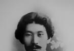
(1846 – 1903)
This simple idea of soil remained until the appearance of works Vasily Vasilievich Dokuchaev.
He discovered the basic laws of genesis (origin) and geographical location of soils . He pointed out the special position of soil in nature, which is determined by the fact that both mineral and organic compounds are involved in its composition.
Proved that an integral part of the soil is living phase - consists of living organisms : plant root systems, soil-dwelling animals, microorganisms.
Vasily Vasilyevich was the first to establish that the soil – it is an independent natural body, qualitatively different from all other bodies of nature.
Vasily Vasilyevich Dokuchaev was born on February 17 (March 1), 1846 in the village of Milyukovo, Smolensk province. He was the third child in a large family of priest Vasily Sergeevich Dokuchaev and Pelageya Trofimovna.
From 1861 he studied at the Smolensk Seminary; his fellow students gave him the nickname “Bashka”, since he was the first in his studies. Having graduated with honors from theological seminary in 1867, Vasily was sent to the St. Petersburg Theological Academy. He studied there for only three weeks.
At this time, he attended public lectures on natural science, given by leading professors in St. Petersburg. Having become interested in science, young Dokuchaev goes to study at the natural sciences department of the Faculty of Physics and Mathematics of St. Petersburg University.
Such outstanding personalities taught at the university as geologist Alexander Aleksandrovich Inostrantsev, agronomist Alexander Vasilyevich Sovetov, botanist Alexey Nikolaevich Beketov, and outstanding chemist Dmitry Ivanovich Mendeleev.
Vasily was especially captivated and aroused his love for science by the interesting and witty lectures of professor of mineralogy Platon Aleksandrovich Puzyrevsky.
Student Dokuchaev led a half-starved existence, earning a living by tutoring. But, despite his difficult financial situation, he showed unprecedented enthusiasm for science. In addition to lectures and seminars, I gained knowledge from books, spending long periods of time in the library. I started receiving a scholarship only in my third year (the scholarship was very rare back then and was awarded only to individual successful students).
After graduating from the university, he remained at the Faculty of Natural Sciences as a conservator (custodian) of the mineralogical collection and held this position from 1872 to 1878. For many years, Dokuchaev taught mineralogy at the Institute of Civil Engineers.
From 1871 to 1877 The scientist, on assignments from the St. Petersburg Society of Naturalists and the Mineralogical Society and the Free Economic Society, of which he was a member, made a number of expeditions to northern and central Russia and the southern part of Finland in order to study the geological structure, method and time of formation of river valleys and the geological activity of rivers.
Dokuchaev managed to collect a lot of factual data that contradicts all existing hypotheses about the origin of river valleys in the European part of Russia. He put forward his own hypothesis, linking this process mainly with the activity of ravines and gullies.
It is interesting that the 32-year-old scientist was not afraid to criticize the views of recognized authorities and discard outdated hypotheses.
He summarized the results of his research in his master’s thesis “ Methods of formation of river valleys in European Russia", which he successfully defended in 1878, and in 1880 he was elected associate professor of the department of mineralogy.
Time from 1877 to 1881 Vasily Vasilyevich was devoted to the study of Russian black soil; For this purpose, he made, on behalf of and at the expense of the Imperial Free Economic Society, multiple trips to the south and southeast of Russia, Crimea and the North Caucasus.
The fruits of many years of research are presented in the monograph “ Russian black soil", which was his doctoral dissertation defended in 1883. This work brought Dokuchaev world fame and is deservedly considered the basis of genetic soil science .
While studying the black earth belt, Vasily Dokuchaev, of course, did not ignore the Ukrainian soils: from the Donetsk region to Bukovina. Gave them a scientific classification. He concluded that “chernozem is an ideal soil”, which can and should become the “king of soils”, because “more expensive than any oil, all kinds of coal, more expensive than gold and iron ores.”
At the invitation of the Poltava provincial zemstvo, in 1888–1894. conducted a large-scale study of soils in the Poltava province.
The expedition included both experienced and young students of Dokuchaev: Georgy Nikolaevich Vysotsky, Vladimir Ivanovich Vernadsky, Konstantin Dmitrievich Glinka, Gavriil Ivanovich Tanfilyev and others. The results of the work done were published in 16 volumes of the report.

During this campaign gray forest soils were isolated and carefully examined for the first time , and the study of solonetzes has begun .
In Poltava, as before in Nizhny Novgorod, Dokuchaev created a natural history museum with a soil department.
Work in the Poltava province finally confirmed his understanding of the laws of soil genesis, his view of soil as a dynamic complex capable of evolution, which is now recognized by soil scientists around the world .
They identified seven world zones: boreal, northern forest, forest-steppe, steppe, dry steppe, aerial desert zone, subtropical.
In 1889, Dokuchaev prepared a collection of soils for the World Exhibition in Paris. In addition to their samples, it included corresponding maps, images of sections, tables, diagrams, etc. “As a representative of V. Dokuchaev,” the future creator of the doctrine of the biosphere was engaged in this exhibition and demonstrated the collection Vladimir Vernadsky. The collection received a gold medal, and Vasily Dokuchaev, as the organizer, was awarded the order “ For services in agriculture».
In 1891, severe droughts and crop failures in southern Russia caused famine among the population. Vasily Vasilyevich together with famous scientists - Kliment Arkadyevich Timiryazev, Pavel Andreevich Kostychev and others - took part in the development of a program to eliminate the consequences of this disaster.
Dokuchaev proposed a plan for the protection of chernozems. In fact, this plan provided for the reconstruction of the entire agriculture of the steppe strip in order to obtain stable high yields.
This plan included the following measures: protecting soils from being washed away; regulation of gullies and ravines and control of soil erosion; artificial irrigation; afforestation and creation of forest shelterbelts; snow retention and regulation of melt water runoff, construction of ponds and small reservoirs; protection of forests and waters; developing the best methods of tillage, maintaining the established ratio between meadow, forest and arable land. This amazing plan is still relevant today.
Vasily Vasilyevich wrote: “If we want to deprive agriculture of the character of a stock exchange game... it is absolutely necessary that all natural factors (soil, climate with water and organisms) be studied and tested, if possible, comprehensively and certainly in their mutual connection.”
In 1982, Dokuchaev published the work “ Our steppes before and now", which sets out an action plan to combat drought in southern Russia (including the lands of Ukraine).
The proceeds from the sale of this book were donated to the famine relief.
Dokuchaev did a lot to promote the science he founded - soil science. Since 1899, on his initiative, the world's first journal “Soil Science” began to be published. He believed that it was necessary, in addition to scientific institutes, to open as many higher agricultural educational institutions as possible and took a direct part in preparing the regulations on the higher agricultural school.
 The soil map was compiled on the initiative and according to the plan of V. Dokuchaev, Scale 60 versts per inch, St. Petersburg, 1900.
 As a true patriot and citizen, he devoted all his strength and knowledge to practical issues of agriculture and the overall economic well-being of Russia;
According to the academician Kliment Arkadyevich Timiryazev, Dokuchaev was a man, " marked by a trait of complete unselfishness, sometimes reaching almost complete oblivion of personal needs».
Vasily Vasilyevich treated the soil not only with the great interest of a scientist, but also with love. Having characterized the principles of soil cover zonation, Dokuchaev concludes: “ A greater connection and genetic affinity is not enough - a greater community and even, so to speak, global self-help and love between individual elements and individual kingdoms of nature cannot be demanded».
In 1897–1900, Vasily Vasilyevich went on expeditions to the Caucasus, Central Asia and Bessarabia. In 1899, he published two works in which, based on the dependence of soils on the factors of their formation, he studied zoning law, open A. von Humboldt. Dokuchaev also came up with the idea for the book “ On the relationship between living and dead nature“, however, he only managed to write the first chapter for it.
In 1900, the geologist was overtaken by an attack of serious illness. At the end of the year, he practically stopped leaving the house. On October 26, 1903, Dokuchaev died.
Vladimir Ivanovich Vernadsky recalled about his teacher: “By his mentality, Dokuchaev was gifted with a completely exceptional plasticity of imagination...
Everyone who had the opportunity to begin his observations in the field under his leadership undoubtedly experienced the same feeling of surprise that I remember when, under his explanations, a dead and silent relief suddenly became animated and gave numerous and clear indications of the genesis and character of geological processes taking place in its hidden depths.”
Vernadsky considered his teacher Vasily Vasilyevich Dokuchaev a great scientist and put him on a par with Lavoisier, Maxwell, Mendeleev, Darwin and other prominent representatives of science of the 19th century.
T.A. Fedorenko
Vasily Dokuchaev’s brief biography and interesting facts from the life of the Russian geologist and soil scientist, the founder of the school of soil science and soil geography are presented in this article.
Brief biography of Vasily Dokuchaev
Vasily Vasilievich Dokuchaev was born March 1, 1846 in the village of Milyukovo in the family of a priest. He received his education at the Vyazmovo Theological School and the Smolensk Theological Seminary.
After graduating from the seminary, he, as the best student, was sent to the Theological Academy of St. Petersburg. But I studied there for only three weeks. Afterwards he transferred to St. Petersburg University to the Faculty of Physics and Mathematics. Inostrantsev, Mendeleev, Beketov, and Soviets had a huge influence on him. Vasily Dokuchaev devoted his thesis to a geological description of the banks of the Kasni River. After completing his studies, he was left at the university as the custodian of the mineralogical collection. He worked here from 1872 to 1878. In parallel with this, Dokuchaev is exploring northern and central Russia, the southern part of Finland in order to study the geological activity of rivers and the processes of formation of river valleys.
In 1875, he was invited to draw up a soil map of European Russia. In 1879, Vasily Vasilyevich came up with the idea of creating a soil museum with a laboratory.
In 1883 he was elected professor and associate professor of mineralogy.
In the period 1888-1894, the provincial zemstvo invited Dokuchaev to explore the Poltava province. The results of the work were published in 16 volumes. He created natural history museums in Poltava and Nizhny Novgorod.
In 1888, thanks to Dokuchaev, the Soil Commission of the Free Economic Society was founded - the first organization of soil scientists. He was the chairman of it. In 1889, also under his chairmanship, a commission was created to study St. Petersburg and the surrounding area. In 1895, Vasily Vasilyevich organized the Bureau of Soil Science under the Scientific Committee of the Ministry of State Property and Agriculture. Also this year, he received consent to create a new soil map.
In the period 1892-1896, Dokuchaev held the position of director of the New Alexandria Institute of Agriculture and Forestry and led its transformation into a higher forestry and agricultural educational institution. In 1894, he organized the first department of soil science at the institute.
In 1895, the scientist fell ill with a nervous disorder. The aggravated disease was accompanied by delirium, headaches, weakening of memory and feelings. Only in 1897 did he return to work. In 1899, his last publications were published: “On the Doctrine of the Zones of Nature”, “On Zoning in the Mineral Kingdom”. Dokuchaev also conceived a book “On the relationship between living and dead nature,” but only managed to write one chapter.
In 1900, the disease made itself felt again. The scientist practically renounces the outside world and dies on November 8, 1903.
Vasily Vasilievich Dokuchaev interesting facts
- He was married to Sinclair Anna Egorovna. Dokuchaev loved his wife very much, and when she died of cancer, the scientist lost the meaning of life.
- Since Vasily Vasilyevich was born into the family of a priest, the family had many children. He had four sisters and two brothers.
- Dokuchaev was the teacher of another famous scientist.
- At school he was first in knowledge, but last in behavior, for which he received the nickname Baska.
- For his scientific activities he was awarded 8 medals and orders.
- Stamps were issued and streets were named in honor of Dokuchaev.
Vasily Vasilyevich Dokuchaev (1846-1903) played a major role in the development of physical geography, both in its general and constructive directions, although he is most and deservedly known as the founder of soil science.
The logic of V.V. Dokuchaev’s development as a naturalist is interesting. He began his scientific career in the field of geology, and was especially active in the study of Quaternary and modern geological phenomena. At the same time, he became interested in soils, and over the next 20 years he worked primarily with this element of the Earth's natural environment.
One of the decisive milestones of his work is the major work “Russian Chernozem” (1883), where a special natural historical body - soil is considered in all complex relationships. Here he is developed the concept of soil-forming process, in which all elements of the environment, as well as time, participate. After establishing such integrated under progress to one natural body, it was easy for him to move on to geography landscape studies.
This was realized in Dokuchaev’s work “Our steppes before and now (1892), where it is no longer one isolated body that is being considered, but an entire natural complex - the steppe zone of Russia. It is important that the scientist points out that our black soil steppes “are an inextricable part of that great steppe belt that completely covers the northern hemisphere.”
Shortly before this, Dokuchaev compiled for the Paris International Exhibition soil map of the world, where the main 6 types of soils “lay down” on the map in completely natural rows along parallels, which was the basis for the scientist’s conclusion regarding regular distribution of soils in the world, therefore, and soil formation factors.
The development of Dokuchaev’s ideas culminates in 5 articles and reports dating back to 1898-1900, later called “The Doctrine of Natural Zones.” In this series of works he substantiates the unity of the nature of the earth's surface and its natural territorial differentiation in the form of geographical zones and altitudinal zones.
Assessing the most important contribution of Dokuchaev to the creation of the foundations of the new geography of the 20th century, L.S. Berg noted: “This doctrine of zones, which is real geography, was first established by V. Dokuchaev. Therefore, we rightly call the great soil scientist also the founder of modern geography...”
In Dokuchaev's works there was practically the issue of the unity of geospheric and geocomplex approaches has been resolved(directions), although among geographers this fact had to be proven for a long time.
It should also be noted that V.V. Dokuchaev were actually new research methods have been created - the first three geographical hospitals, which made up the meridional section of the steppe zone: Khrenovskoe, Velikoanadolskoe and Starobelskoe forestries, stationary research in which was begun during the Special Expedition of the Forestry Department of 1892-1897, organized in connection with the catastrophic drought of 1891. It is also important justify e Dokuchaev genetic approach to the study of natural processes and phenomena, in combination with the classical comparative spatial method. He called this “symbiosis” special natural historical method a house that was developed and used during three major expeditions of Dokuchaev: Nizhny Novgorod (1882-1886), Poltava (1888-1894), organized to assess land resources, as well as the above-mentioned Special Expedition.
V.V. Dokuchaev paid a lot of attention interaction between nature and man. In one of his last notes he wrote about the exhaustibility of natural resources and the conflict between nature and man. As a scientist, he suggests a possible way to overcome this conflict by development of science about the relationship between living and dead matter: “We are firmly convinced that if anyone or anything can contribute to this great grief, it is precisely the doctrine of the relationship between living and dead nature in general and soil science, which lies at the center of this doctrine, in particular.”
This attitude of a scientist to a problem is not only academic, but also completely constructive. From a modern point of view problems of constructive geography(constructive and transformative direction) Dokuchaev’s activities are of exceptional importance on the theoretical basis of afforestation and watering of arid zones of Russia and practical work during the years of operation of the Special Expedition. That's when they were forest strips and tracts were laid out in Kamennaya st. forests, which later became an experimental testing ground for the problem of shelterbelt afforestation.
Main directions of development of economic and social geography
At the turn of the 19th and 20th centuries. in world geographical science the so-called anthropogeography, which continued the traditions of K. Ritter in an even more ecologized form, that is studying nature as a human habitat. An outstanding representative of this trend was Friedrich Ratzel(1844-1904) - professor at the University of Leipzig, author of such major works as “Earth and Life”, “Anthropogeography”, “Political Geography”, “Ethnic Studies”, and many others (in total more than 20 multi-volume works and more 1200 articles and notes).
According to Ratzel, a key element of geography is regional studies, in which a synthesis of natural science and socio-historical directions is carried out. The essence of his anthropogeographical concept lies in the unity of geographical description and historical explanation. As he believed, anthropogeography should acquaint us not only with what humanity is now, but also with how it became so.
So Ratzel is quite right pointed out the importance of genetic and historical approaches for the explanatory tactics of geography and productively used one of the fundamental methods of explaining geographical reality. In his main works (on the relationship between man and the natural environment), he tried to paint a general picture of the settlement of mankind on the earth's surface and the development of culture in connection with geographical conditions.
In this endeavor, he, largely repeating the reasoning of K. Ritter and considering himself his student, tried to formulate the concept of a unified geography, based on the recognition of the conditionality of social development by geographical factors. At the same time, Ratzel considered geography of society primarily as a branch of biogeography: “The relationship of man to the soil is the same as the relationship to it of all living things. The universal laws of the distribution of life also cover the laws of the distribution of human life. Therefore, anthropogeography is conceivable only as a branch of biogeography, and a whole series of biogeographical concepts can be directly transferred to questions about the distribution of man ".
According to Ratzel, social phenomena are not only explained by the influence of natural conditions, but, in his opinion, the study of the development of nature itself must be approached depending on political objectives.
From F. Ratzel in the history of geography we went two lines: geopolitical and possibilistic.
Geopolitical line was developed in the works of a number of scientists in Western Europe. This line was especially clearly manifested in the work of the first professor of geography at Oxford University X. Mackinder"Britain and the British Seas" (1902), in which anthropogeography merged with political geography on the platform of geographical determinism. The unity of geography, according to Mackinder, lies primarily in the subordination of all geographical problems (physical, biological and social) to the influence of politics. Human society, in his view, is a combination of unions uniting in the process of struggle for their existence. Decisive factor in social development he considered the so-called " geographic inertia", that is geographical conditionality, the determining, initial position of which, in turn, was declared to be the geographical location. The latter was given exaggerated significance. The population was considered by Mackinder only as a part of nature, as a weak-willed mass, entirely subject to the action of the law of “geographical inertia.”
In the future, especially K. Haushofer, geopolitics was heavily ideologized and turned into vulgar geography - a faithful servant of the most reactionary lines of politics: fascism (for example, in Hitler's Germany), racism and colonialism. E. Sample this direction was transferred to the USA under the name environmentalism. In the latter it was carried out geographical justification for the existence of nations and social groups destined by nature itself, a combination of geographical factors, to rule the world. A similar line continued until the 60s. XX century
(Student of F. Ratzel Ellen Churchill Semple propagated the ideas of F. Ratzel in the USA, where the doctrine of “geographical control” over the destinies of humanity was called environmentalism (from the English environment - environment, surroundings). E. C. Semple's most famous work, The Influence of the Geographical Environment (1911), begins with the words: “Man is a product of the earth's surface.” The works are especially widely known Ellsworth Huntington. According to his ideas, in all eras the development of civilization was determined by climate; climate determines religions, the ripples of culture, fluctuations in iron production or stock prices, and even the ability of peoples to resist tyranny.)
Possibilistic line was developed by P. Vidal de la Blache and his school. The ecological model of society served as the methodological platform, namely - descriptions of the mechanisms of adaptation of the economy and human life to the environment. It is quite natural that French scientists should have been more interested in archaic forms of economic activity, ignoring the geography of new industries and new trends in population geography, little dependent on environmental conditions.
Economic direction continued in geography statistical line previous periods in the history of geographical knowledge. At the end of the 19th century. most of all it was presented by German scientists V. Gotts who coined the term " economical geography"; English geographer J. Chisholm– author of the “Guide to Commercial Geography”, Russian economist and economic geographer V. E. Denom- the first professor who began to read economic geography under its modern name, and many other scientists.
Work in this direction is still were filled with statistical data about countries and sectors of the economy, as well as descriptions of technological processes of production and trade. The status of such geography was widely recognized, and it was responsible for preparing information surveys for the colonial and military departments. Both foreign and domestic trade needed such information. Works of this kind contained a huge geographical nomenclature, which resulted from the characteristics of the genre. Opponents of this trend, in the heat of heated discussions, not noticing its rational grain, very contemptuously called it “the geography of capes and bays.”
However, all of the above directions that developed at the turn of the century could not satisfy interests of entrepreneurs who sought the most profitable location of their production with the lowest transport costs. At the end of the 19th and beginning of the 20th centuries, due to the widespread development of industrial construction, a request arises for such placement that would have the lowest production costs in the “raw materials-production-market” system. To satisfy this request, a direction arose standard(from German Standort-location), which believed that through mathematical and spatial constructions it was possible to find a way rational placement of production .
This direction is based on the work of I. Thunen discussed above, which can be called agriculture standard. Among many works, representatives of this direction in our country are best known for their work A. Weber“The Theory of Industrial Location” (1909, Russian translation, 1926). Weber's theory of placement, like Thunen's theory, is a formalized theory emanating from significant abstraction from the conditions of reality:
· extraction of raw materials, consumption and labor markets are constant and inexhaustible;
· the enterprise produces only one product and is a full-cycle enterprise;
The location of industry is determined by:
a) transport orientation - the desire for the lowest transport costs;
b) work orientation - approaching points with cheaper labor;
c) agglomeration - the desire to locate other industrial enterprises in cluster centers for the rational use of infrastructure.
The influence of each factor is determined by constructing the corresponding geometric figure. Weber introduces the concept material warehouse. The number of "warehouses" corresponds to the number of raw materials used to manufacture the product. Therefore, the geometric figure corresponds to the number of material warehouses and the number of sales locations (markets). If there are two material warehouses and one sales point, then a triangle is built, etc. Transportation costs are calculated by the weight and manufacturability of the transported materials, and, based on this, the distance of the stand point from the material warehouses and sales points is determined.
All of the above applies to the first, transport, orientation of industrial location. It is quite clear that the standard of an enterprise is decided in a similar way based on two other factors. The final solution is obtained from the correlation of locations across all three factors.
The industry standart of A. Weber has received wide recognition. It is a way of formalizing, under conditions of limited possibility of an approximate solution, such a multifactorial phenomenon as the location of a farm. With the introduction of computers, the ability to solve nonlinear programming problems increases, which is what is associated with the modern revival of standort theories.
The industrial standard theory was outlined by the German economist Alfred Weber in a book published in 1909. According to A. Weber’s theory, the location of production enterprises is determined by three “orientations” - transport, labor and sintering, i.e., the desire of entrepreneurs to locate their enterprises in centers of concentration of similar enterprises. A. Weber justified the choice of location for an industrial enterprise by the lowest production costs. His merit also lies in the fact that he connected the standard of industry with economic geography itself, moreover, introducing into it the method of mathematical calculations.
The theory of the industrial stand was further developed in the works of a number of other Western scientists, and especially the German economist-geographer August Loesch. Unlike his predecessors, A. Loesch proceeded from the fact that the main motivating impulse when choosing a location for an enterprise is the desire to obtain maximum profit.
The theory of the standort aroused some interest in Russia, especially since the books of I. Thunen, A. Weber and A. Lesch were translated into Russian, the second with a preface by N. N. Baransky, and the third by Ya. G. Feigin. But a society with a planned economy needed its own theory of production location, and almost all major Soviet economic geographers, as well as many prominent economists, participated in its formation. At the same time, the focus was on truly fundamental questions about the laws, patterns, factors and principles of the location of socialist production. The literature on all these issues is very large. But, unfortunately, we have to admit that several decades of work were not enough for the theory of placement to acquire sufficient coherence.
Based on existing methodological principles, theorists of economic geography believed that all aspects and processes of socialist production, including its location, are determined by the basic economic law of socialism. Its derivatives are special (private) economic laws - the law of labor saving, the laws of concentration, specialization, cooperation and combination of production, the law of social division of labor, etc. As for the placement aspects, they are no longer determined by laws, but by patterns that represent spatial modifications of economic laws.
Rice. 16. Zones (“rings”) of specialization by I. Thunen
At the turn of the century there also continued experiences of zoning at different territorial levels. These include the already mentioned and other experiments of zoning the European part of Russia by P. P. Semenov-Tyan-Shansky (1871, 1880, 1912); division of Africa into three landscape regions with their further fractional division by Z. Passarge (1908), division of Siberia and Turkestan into morphological and landscape regions by L.S. Berg (1913); division of the Earth's surface into "territories" of various sizes by C. B. Fossett (1919), etc.
Thus, at the turn of the 19th and 20th centuries. Geography, while retaining many of the achievements of previous periods of development, has undergone significant changes.
One of the significant features of this period was the sharp differentiation of the Earth sciences, manifested in the emergence of new “daughter” geographical sciences. But it would be a mistake to consider this a crisis phenomenon, as some historians of geography do. The emergence of new sciences is not an exclusive manifestation of differentiation, since differentiation and integration do not go one after another, but appear simultaneously, one in the other and through the other. Thus, the emergence of geomorphology was simultaneously the revelation of a new side of the object, therefore, the emergence of a new science, and at the same time it was a manifestation of the unity of the geological and geographical sciences. Thus, differentiation simultaneously “destroys” and “creates,” which expresses the dialectical contradiction between integration and differentiation.
However, at the turn of the century physical and economic geography have moved significantly away from each other, because the first, in search of cause-and-effect relationships, turned towards physics; the second, for the same purposes, towards history and sociology. Synthetic category territories, despite the efforts of A. Gettner, L.S. Berg and other scientists - their followers, faded into the background.